place

Cadogan Lane

BelgraviaMews streets in LondonStreets in the Royal Borough of Kensington and Chelsea
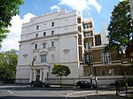
Mid section of Cadogan Lane geograph.org.uk 1089336

Cadogan Lane, originally Little Cadogan Place, is a street in London's Belgravia which runs between Pont Street in the north, and a junction with Cadogan Place and D'Oyley Street in the south. It is one of the streets in the area named after the Earls of Cadogan that began to be developed in 1777. The lane was laid-out by 1799 but had few buildings until the twentieth century. Today it is mostly made up of small mews houses which back onto the larger houses in Cadogan Place, and Chesham Place and Chesham Street, between which Cadogan Lane runs.

Excerpt from the Wikipedia article Cadogan Lane (License: CC BY-SA 3.0, Authors, Images).

Cadogan Lane
Cadogan Lane, London Chelsea (Royal Borough of Kensington and Chelsea)

Geographical coordinates (GPS) Address Nearby Places
placeShow on map

Wikipedia: Cadogan LaneContinue reading on Wikipedia

Geographical coordinates (GPS)

Latitude Longitude
N 51.4963 ° E -0.1566 °
placeShow on map

Address

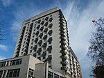
Chalfont House

Cadogan Lane 37-49
SW1X 9EJ London, Chelsea (Royal Borough of Kensington and Chelsea)
England, United Kingdom
mapOpen on Google Maps

Mid section of Cadogan Lane geograph.org.uk 1089336
Share experience

Nearby Places

Cadogan Place
Cadogan Place

Cadogan Place is a street in Belgravia, London. It is named after Earl Cadogan and runs parallel to the lower half of Sloane Street. It gives its name to the extensive Cadogan Place Gardens, private communal gardens maintained for Cadogan residents. It is owned by Cadogan Estates.Cadogan Place is considered part of Prime Central London, an area of high property values that are popular with foreign buyers, particularly from the Middle East and China. The average value of a property in Cadogan Place was estimated at £5 million in 2020; with flats selling for an average of £3.1 million and terraced houses for £11.1 million.Nos. 21–27, 28–33, 34–69, and 70–90 Cadogan Place are listed Grade II on the National Heritage List for England as are the two bollards outside 70 Cadogan Place marked 'Hans Town 1819'. The 3 hectares (7.4 acres) of communal gardens, known as the North and South gardens, are also Grade II listed on the Register of Historic Parks and Gardens. The Carlton Tower Hotel is situated at the north end of Cadogan Place. It is bordered to the west by Sloane Street and bisected by Pont Street to the north which runs east to west from Cadogan Place to Sloane Street. The eastern side of Cadogan Place is defined by its long stuccoed terraces built in the early 19th century.The 10 tonne 'Belgravia Fatberg', a fatberg made up of grease, fat, and "unflushable" wet wipes was found under Cadogan Place in October 2020. It was removed by engineers from Thames Water, who said that it weighed more than an African elephant.The northern garden was laid out by Humphry Repton in 1806. Repton laid out winding paths and created ridges and dips from excavated soil. An underground car park was created in the 1970s underneath the northern garden. The garden features rosebeds and shrubs and a summerhouse. A bronze sculpture of two figures by David Wynne is situated in the northern garden.