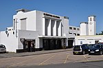
A307 road
Geographic coordinate listsInfobox road instances in EnglandInfobox road maps tracking categoryLists of coordinatesRoads in London ... and 4 more
Roads in SurreyStreets in the London Borough of Richmond upon ThamesTransport in the Royal Borough of Kingston upon ThamesUse British English from February 2013

The A307 road runs 13.2 miles (21.2 km) through SW London and NW Surrey. It is primary at the north-east end; the remainder is non-primary, generally superseded in the mid-twentieth century in two stages by newer alignments of the Portsmouth Road, the Kingston bypass and Esher bypass of the A3, which runs along a slightly oblique axis.
Excerpt from the Wikipedia article A307 road (License: CC BY-SA 3.0, Authors, Images).A307 road
Portsmouth Road, London Surbiton (Royal Borough of Kingston upon Thames)
Geographical coordinates (GPS) Address Nearby Places Show on map
Geographical coordinates (GPS)
| Latitude | Longitude |
|---|---|
| N 51.3972 ° | E -0.3108 ° |
Address
Portsmouth Road
Portsmouth Road
KT6 4HS London, Surbiton (Royal Borough of Kingston upon Thames)
England, United Kingdom
Open on Google Maps


