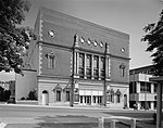
Juniata Gap, Pennsylvania
Census-designated places in Blair County, PennsylvaniaCensus-designated places in PennsylvaniaUse mdy dates from July 2023Western Pennsylvania geography stubs
Juniata Gap is an unincorporated community and census-designated place (CDP) in Blair County, Pennsylvania, United States. It was first listed as a CDP prior to the 2020 census.The CDP is in western Blair County, in the northwestern part of Logan Township. It sits on the north side of Spring Run at the base of the Allegheny Front, which rises to an elevation of 2,542 feet (775 m) one mile to the west. Juniata Gap Road is the main route through the community, leading northwest up Spring Run onto the Allegheny Plateau at Wopsononock and southeast into the northern part of Altoona.
Excerpt from the Wikipedia article Juniata Gap, Pennsylvania (License: CC BY-SA 3.0, Authors).Juniata Gap, Pennsylvania
Juniata Gap Road, Logan Township
Geographical coordinates (GPS) Address Nearby Places Show on map
Geographical coordinates (GPS)
| Latitude | Longitude |
|---|---|
| N 40.548888888889 ° | E -78.429444444444 ° |
Address
Juniata Gap Road 3577
16601 Logan Township
Pennsylvania, United States
Open on Google Maps


