place

RAF Bodney

Airfields of the VIII Fighter Command in the United KingdomHilboroughPortal templates with redlinked portalsRoyal Air Force stations in NorfolkRoyal Air Force stations of World War II in the United Kingdom
Use British English from May 2013
RAF Bodney 18 Apr 1944 Airfield

Royal Air Force Bodney or more simply RAF Bodney is a former Royal Air Force Station located 4.5 miles (7.2 km) west of Watton, Norfolk, England. Originally built as an RAF Bomber Command airfield during 1939-1940, Bodney was transferred to the United States Army Air Forces in the summer of 1943. Placed under the jurisdiction of VIII Fighter Command of Eighth Air Force, it was primarily the home of the 352d Fighter Group, the "Blue Nosed Bastards of Bodney". The unit briefly moved to Belgium in January 1945 due to the Battle of the Bulge, although it returned in April. It was closed after the 352d returned to the United States in November.

Excerpt from the Wikipedia article RAF Bodney (License: CC BY-SA 3.0, Authors, Images).

RAF Bodney
Hüttenhof, Bad Salzungen

Geographical coordinates (GPS) Address Nearby Places
placeShow on map

Wikipedia: RAF BodneyContinue reading on Wikipedia

Geographical coordinates (GPS)

Latitude Longitude
N 52.562222222222 ° E 0.71333333333333 °
placeShow on map

Address

Hüttenhof 2
36469 Bad Salzungen (Tiefenort)
Thüringen, Deutschland
mapOpen on Google Maps

RAF Bodney 18 Apr 1944 Airfield
Share experience

Nearby Places

Buckenham Tofts
Buckenham Tofts

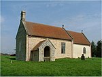
Buckenham Tofts (or Buckenham Parva; Little Buckenham) is a former civil parish, now in the parish of Stanford, in the Breckland district, in the county of Norfolk, England, situated about 7 miles north of Thetford, and since 1942 situated within the Stanford Training Area, a 30,000-acre military training ground closed to the public. It was situated about one mile south of the small village of Langford, with its Church of St Andrew, and about one mile west of Stanford, with its All Saints' Church and one mile north of West Tofts, with its Church of St Mary, all deserted and demolished villages. None of these settlements (except West Tofts) are shown on modern maps but are simply replaced by "Danger Area" in red capital letters. In 1931 the parish had a population of 60. On 1 April 1935 the parish was abolished and merged with Stanford.It is situated within Breckland heath, a large area of dry sandy soil unsuited to agriculture. The parish church of Buckenham Tofts, dedicated to St Andrew, was demolished centuries ago and stood to the immediate north of Buckenham Tofts Hall, the now-demolished manor house, as is evidenced by a graveyard which was discovered in that location. The parishioners, few as they were, used nearby St Mary's Church, West Tofts, one mile to the south, where survive 18th-century monuments to the Partridge family of Buckenham Tofts. In 1738 the Norfolk historian Blomefield stated of Buckenham Tofts "there is nothing remaining of this old village, but the Hall, and the miller's house". The ancient manor house was rebuilt in 1803 by the Petre family in the Georgian style and on a grand scale, was sold with the large estate in 1904 and was finally demolished by the army in 1946, having suffered major damage from military training exercises and shelling. In the early 21st century the remains of the manor house were described as follows: "a grassy platform of raised ground and beside a short line of dilapidated stone steps. The raised ground made a sort of elevated lawn, large enough for a tennis court or two, and the steps went to the top of the platform, and then went nowhere."

South Pickenham
South Pickenham

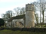
South Pickenham is a small village and civil parish in the Breckland district of mid Norfolk, East Anglia, England. It has an area of 758 hectares (2.93 square miles) and it had a population of 101 in 40 households at the 2001 census. This had dropped to an estimated 85 as at the 2007/2008 Breckland yearbook. The Parish Council Tax (Band D) 1 April 2007 was £28.75. It was once in the Hundred of South Greenhoe. At the 2011 Census the village population had again fallen to less than 100 and was included in the civil parish of Cockley Cley. The village is about 4 miles south east of Swaffham and 2 miles from its sister village North Pickenham. The village is centered on the Grade-II listed Pickenham Hall, still the landlord for much of the village, which is owned by the Arumugam Packiri family. The original hall was designed by William Donthorne but between 1902 and 1905 architect Robert Weir Schultz extensively rebuilt and enlarged the hall, incorporating the previous house, in the style of the Arts and Crafts movement. The military training area Stanta lies to the south of the parish. The historic church, All Saints, is one of only 124 existing round-tower churches in Norfolk, 185 nationwide and 5 within a 9-mile radius.The restored church of Saint Mary's at Houghton on the Hill is nearby. Historically part of North Pickenham since 1725, a Pastoral Order was raised transferring it to South Pickenham as a Chapel of Ease in 1992. The 46 mile Peddars Way runs to the east, within the parish boundaries, aside the course of the River Wissey. South Pickenham Estate Co. Ltd., a large arable and livestock farming company, is based in the village.