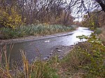
Mud Island (Michigan)
Islands of Wayne County, MichiganIslands of the Detroit RiverRiver islands of MichiganSoutheast Michigan geography stubs

Mud Island is an island in the Detroit River International Wildlife Refuge, in southeast Michigan. It is in Wayne County. Its coordinates are 42°14′20″N 83°08′27″W; the United States Geological Survey gave its elevation as 584 ft (178 m) in 1980. Once owned by National Steel, white bass and perch are now caught there.
Excerpt from the Wikipedia article Mud Island (Michigan) (License: CC BY-SA 3.0, Authors, Images).Mud Island (Michigan)
West Jefferson Avenue,
Geographical coordinates (GPS) Address Nearby Places Show on map
Geographical coordinates (GPS)
| Latitude | Longitude |
|---|---|
| N 42.238888888889 ° | E -83.140833333333 ° |
Address
Grand Port Cafe
West Jefferson Avenue 4453
48229
Michigan, United States
Open on Google Maps


