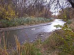
Grassy Island

Grassy Island is a small, uninhabited 72-acre (29 ha) American island in the Detroit River. It is located just north of Grosse Ile and west of Fighting Island, about 600 feet (180 m) west of the Canada–United States border. The island is part of the city of Wyandotte, in Wayne County. The island is part of the Detroit River International Wildlife Refuge. Grassy Island should not be confused with Grass Island, which is an island of Ontario on the exact opposite side of the Detroit River.Grassy Island was first charted by French explorers in 1796 as Ile Marecageuse (Marshy Island). At the time, the island's size was only six acres (2.4 ha), and the whole length of the Detroit River was a prominent coastal marshland. During the nineteenth century, the island was primarily used as a fishery and later was home to the Grassy Island Light. From around 1960–1982, the island served as a disposal facility for millions of cubic meters of toxic soil dredged from the nearby River Rouge, and the island's size was increased dramatically. Because of that, the island remains heavily contaminated today.
Excerpt from the Wikipedia article Grassy Island (License: CC BY-SA 3.0, Authors, Images).Grassy Island
Geographical coordinates (GPS) Address Nearby Places Show on map
Geographical coordinates (GPS)
| Latitude | Longitude |
|---|---|
| N 42.2225 ° | E -83.134722222222 ° |
Address
Wyandotte
48192
Michigan, United States
Open on Google Maps


