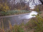
Council Point Park
Council Point Park is a city-owned park in Wayne County in the U.S. state of Michigan. It is located along the Ecorse River within the city of Lincoln Park. The park is 27 acres, and borders the cities of Wyandotte and Ecorse. The point itself is formed by the northern and southern branches of the Ecorse River, just before it reaches the Detroit River. The land for the park was purchased in the late 1980s. The park's dimensions were courtesy of Wade Trim and Associates. The park includes a 1.9 mile jogging track along the Ecorse River, two baseball/softball diamonds, two soccer fields, a picnic pavilion, a children's park with a playscape, an inline hockey arena, and a permanent restroom/storage building.
Excerpt from the Wikipedia article Council Point Park (License: CC BY-SA 3.0, Authors).Council Point Park
River Drive,
Geographical coordinates (GPS) Address Nearby Places Show on map
Geographical coordinates (GPS)
| Latitude | Longitude |
|---|---|
| N 42.235555555556 ° | E -83.161944444444 ° |
Address
River Drive
River Drive
48146
Michigan, United States
Open on Google Maps


