place

Filago

Cities and towns in LombardyMunicipalities of the Province of BergamoProvince of Bergamo geography stubs
Marne1
Marne1

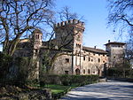
Filago (Bergamasque: Filàgh) is a comune (municipality) in the Province of Bergamo in the Italian region of Lombardy, located about 35 kilometres (22 mi) northeast of Milan and about 12 kilometres (7 mi) southwest of Bergamo. Filago borders the following municipalities: Bonate Sotto, Bottanuco, Brembate, Capriate San Gervasio, Dalmine, Madone, Osio Sopra, Osio Sotto.

Excerpt from the Wikipedia article Filago (License: CC BY-SA 3.0, Authors, Images).

Geographical coordinates (GPS)

Latitude Longitude
N 45.633333333333 ° E 9.55 °
placeShow on map

Address


24041
Lombardy, Italy
mapOpen on Google Maps

Marne1
Marne1
Share experience

Nearby Places

Osio Sopra
Osio Sopra

Osio Sopra (Bergamasque: Öss de Sura) is a comune (municipality) of 5,306 inhabitants in the province of Bergamo, Lombardy, Italy. The history of Osio Sopra has significant links to Osio Sotto's. Early settlements can be traced to Ancient Roman times, when an important communication road linked Milan to Bergamo passing through the bridge 'Ponte Corvo' in the Marne locality. In Bergamo, the last section of this road was in-fact named 'via Osio', highlighting the importance of the location. During those times, Osio underwent an important process of centuriation, with which a first development of the 'pagus' took place; the name 'Osio' originates from the Patrician 'gens Otia' (or gens Oxia). Among Osio Sopra's landmarks, the medieval Catholic church of San Zenone features good quality paintings of Lombard artists. Legend has it that this sacred church was built with materials from an ancient castle. The Santuario della Madonna della Scopa is a chapel located on the border Osio Sopra shares with Osio Sotto. Built in the fifteenth century, it was initially much smaller than it is today, with the most recent extension added at the beginning of the twentieth century. Religious frescoes cover its inner walls. According to the legend, the name of the chapel ('Madonna della scopa' is Italian for 'Madonna of the broom') is due to a miraculous apparition in which the Virgin Mary intervened to clean up this chapel at a time in which it had been abandoned. Finally, Palazzo Camozzi-Andreani, also known as Villa Andreani or more colloquially as Palazzo delle Gigine, was built during the eighteenth century as a library. Osio Sopra's western border consists of the river Brembo; along its shore, a number of natural reserves such as Bosco Astori are frequented by locals and visitors for recreational purposes.

Naviglio Martesana
Naviglio Martesana

The Naviglio della Martesana (Lombard: Nivili de la Martexana or Martesanna [niˈʋiːri de la marteˈzana]) is a canal in the Lombardy region, Northern Italy. Running from the Adda river, in the vicinity of Trezzo sull'Adda, to Milan, it was also known as Naviglio Piccolo (Lombard: Navijett [naʋiˈjɛt]). It is part of the system of navigli of the Milan area. Approximately 38 kilometres (24 mi) long, with a substantial section covered over or infilled, its width varies between 9 and 18 metres (30 and 59 ft), while the depth is between one and three metres (3 and 10 ft). Originally named Naviglio Piccolo, it subsequently changed to Martesana from the name of the county across which it runs. Along the way it crosses the boundaries of the villages of Trezzo sull'Adda, Vaprio d'Adda, Cassano d'Adda, Inzago, Bellinzago Lombardo, Gessate, Gorgonzola, Bussero, Cassina de' Pecchi, Cernusco sul Naviglio and Vimodrone, and takes the name Martesana from this area (Martesana County was established during the late Roman ages). The canal enters Milan alongside Via Padova until Cassina dei Pom: at the junction with Via Melchiorre Gioia it disappears underground following the route of Via Melchiorre Gioia itself southwards. In the past it would have passed through the Fossa dell'Incoronata and the Laghetto di San Marco to connect with the Fossa Interna (or Inner Ring). Today, after merging with the river Seveso, the underground course becomes the Cavo Redefossi in the vicinity of Porta Nuova, runs under the cerchia dei bastioni to Porta Romana, follows Corso Lodi and Via Emilia, finally ending up in the River Lambro.