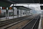
Senago
Cities and towns in LombardyMunicipalities of the Metropolitan City of MilanProvince of Milan geography stubs

Senago (Lombard: Senagh [seˈnɑːk]) is a comune (municipality) in the Metropolitan City of Milan in the Italian region Lombardy, located about 13 kilometres (8 mi) north of Milan. As of 30 November 2017, it had a population of 21.519 and an area of 8.6 square kilometres (3.3 sq mi).Senago borders the following municipalities: Limbiate, Cesate, Paderno Dugnano, Garbagnate Milanese, Bollate. The Villa San Carlo Borromeo is located in Senago. A historic residence, that has been built in the XIV century, it is immersed in a secular park of eleven hectares, 12 kilometers from Milan.
Excerpt from the Wikipedia article Senago (License: CC BY-SA 3.0, Authors, Images).Senago
Via Don Giovanni Fumagalli,
Geographical coordinates (GPS) Address Nearby Places Show on map
Geographical coordinates (GPS)
| Latitude | Longitude |
|---|---|
| N 45.583333333333 ° | E 9.1333333333333 ° |
Address
Via Don Giovanni Fumagalli
Via Don Giovanni Fumagalli
20030
Lombardy, Italy
Open on Google Maps


