place

San Giorgio su Legnano

Cities and towns in LombardyHarv and Sfn no-target errorsMunicipalities of the Metropolitan City of MilanSan Giorgio su Legnano

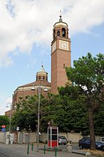
San Giorgio su Legnano (Legnanese: San Giorgiu) is a comune (municipality) in the Metropolitan City of Milan in the Italian region Lombardy, located about 20 kilometres (12 mi) northwest of Milan. San Giorgio su Legnano borders the following municipalities: Legnano, Villa Cortese, Canegrate, Busto Garolfo. It is located in the Po Valley northwest of Milan, from which it is 34 km away, near the valley in which the Olona river flows. Located slightly higher than the neighbouring Legnano (hence the preposition "su", en. "up", in the name), it is one of the smaller municipalities in the metropolitan city of Milan. Since 1957, the town has hosted the annual Campaccio competition, a cross country running event which attracts world class athletes. On 10 December 2006, San Giorgio su Legnano hosted the 2006 European Cross Country Championships.

Excerpt from the Wikipedia article San Giorgio su Legnano (License: CC BY-SA 3.0, Authors).

San Giorgio su Legnano
Via Fratelli Rosselli,

Geographical coordinates (GPS) Address Nearby Places
placeShow on map

Wikipedia: San Giorgio su LegnanoContinue reading on Wikipedia

Geographical coordinates (GPS)

Latitude Longitude
N 45.566666666667 ° E 8.9166666666667 °
placeShow on map

Address

Via Fratelli Rosselli

Via Fratelli Rosselli
20039
Lombardy, Italy
mapOpen on Google Maps

Share experience

Nearby Places

Parco del Roccolo
Parco del Roccolo

The Parco del Roccolo is a local park of interest to more than one municipality and it is located between the rivers Olona and Ticino in the northern part of the Po Valley, in a north-western area in the province of Milan, on the southern edge of the Altomilanese. The park includes wooded and agricultural areas in the municipalities of Arluno, Busto Garolfo, Canegrate, Casorezzo (where the park headquarters are located), Nerviano (since 1997) and Parabiago, with a surface of 1595 hectares (about 16 km²). The park takes its name from a technique once used in bird trapping, now considered illegal, the Roccolo: an oval clearing in which stood a three-storey tower camouflaged among the vegetation. It was established in 1991 for the safeguard of the natural elements of the area and for the enhancement of agriculture, which involves about 80% of the surface of the park, with the cultivation of corn, wheat, oats, barley, soybeans and fodder. Of the remaining land area, 9% is characterized by forests, while 1% by roads, quarries and the Villoresi canal with its network of secondary irrigation canals. Another characteristic of the park is the presence of numerous farmhouses scattered throughout its territory, witnesses to the historical agricultural past of the area. Recognized in 1994 as an agricultural park of supra-municipal interest by the Lombardy Region, it is currently being extended to the WWF Oasis of the Vanzago woods.