Government Center, Boston

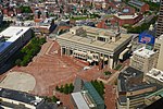
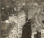
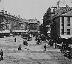
Government Center is an area in downtown Boston, centered on City Hall Plaza. Formerly the site of Scollay Square, it is now the location of Boston City Hall, courthouses, state and federal office buildings, and a major MBTA subway station, also called Government Center. Its development was controversial, as the project displaced thousands of residents and razed several hundred homes and businesses.Controversial in design since before it was completed, the use of Brutalist architecture for its main buildings, as well as the open brick-and-concrete plaza at the center of the development, have been alternately praised for its innovative design, and scorned for its lack of character and uninviting appearance. After decades of calls for a redesign to make it more friendly and usable, a major rebuild of City Hall Plaza, the main public space of Government Center, was begun in 2020 and is to include additional seating areas, play spaces for children, and space for public art.
Excerpt from the Wikipedia article Government Center, Boston (License: CC BY-SA 3.0, Authors, Images).Government Center, Boston
Sudbury Street, Boston
Geographical coordinates (GPS) Address Nearby Places Show on map
Geographical coordinates (GPS)
| Latitude | Longitude |
|---|---|
| N 42.3607 ° | E -71.059227777778 ° |
Address
Government Center
Sudbury Street
02203 Boston
Massachusetts, United States
Open on Google Maps


