place

Church of St Mary and All Saints, Droxford

Church of England church buildings in HampshireEnglish churches with Norman architectureGrade I listed churches in Hampshire
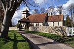
Eastern end of St Mary and All Saints, Droxford geograph.org.uk 1124601

The Church of St Mary and All Saints is an Anglican church in the village of Droxford, in Hampshire, England. It is in the Diocese of Portsmouth, and is one of the churches of the Meon Bridge Benefice. The building is Grade I listed; the earliest parts of the church date from the Norman period.

Excerpt from the Wikipedia article Church of St Mary and All Saints, Droxford (License: CC BY-SA 3.0, Authors, Images).

Church of St Mary and All Saints, Droxford
Mill Lane, Winchester Droxford

Geographical coordinates (GPS) Address External links Nearby Places
placeShow on map

Wikipedia: Church of St Mary and All Saints, DroxfordContinue reading on Wikipedia

Geographical coordinates (GPS)

Latitude Longitude
N 50.960111111111 ° E -1.1360277777778 °
placeShow on map

Address

Saint Mary and All Saints

Mill Lane
SO32 3QS Winchester, Droxford
England, United Kingdom
mapOpen on Google Maps

linkWikiData (Q17528648)
linkOpenStreetMap (285978596)

Eastern end of St Mary and All Saints, Droxford geograph.org.uk 1124601
Share experience

Nearby Places

Droxford railway station

Droxford railway station was an intermediate station on the Meon Valley Railway, built to a design by T. P. Figgis and opened in 1903. It served the villages of Droxford, Soberton and Hambledon in Hampshire, England. The railway served a relatively lightly populated area, but was built to main line specifications in anticipation of it becoming a major route to Gosport. Consequently, although the station was built in an area with only five houses, it was designed with the capacity to handle 10-carriage trains. It initially proved successful both for the transport of goods and passengers, but services were reduced during the First World War and the subsequent recession, and the route suffered owing to competition from road transport. In 1944, amid World War II, Droxford station was used by the Prime Minister Winston Churchill as his base during preparations for the Normandy landings. Based in an armoured train parked in the sidings at Droxford, Churchill met with numerous ministers, military commanders and leaders of allied nations. On 4 June 1944, shortly before the landings were due to take place, Free French leader Charles de Gaulle visited Churchill at Droxford, and was informed of the invasion plans. When discussing the future governance of liberated France at this meeting, Churchill expressed his view that if forced to side with France or the United States he would always choose the United States, a remark which instilled in de Gaulle a suspicion of British intentions and caused long-term damage to the postwar relationship between France and Britain. After the war, with Britain's railway network in decline, services on the Meon Valley Railway were cut drastically. A section of the line north of Droxford was closed, reducing Droxford to being the terminus of a short 9+3⁄4-mile (15.7 km) branch line. In early 1955 the station closed to passengers, and in 1962 it closed to goods traffic. Following its closure, Droxford station and a section of its railway track were used for demonstrating an experimental railbus until the mid-1970s. It then briefly served as a driving school for HGV drivers, before becoming a private residence and being restored to its original appearance.

Exton, Hampshire
Exton, Hampshire

Exton is a small village and civil parish in the City of Winchester district of Hampshire, England. The village lies in the South Downs National Park, on the west bank of the River Meon, immediately to the north of Corhampton. It is located two miles north of Droxford and five miles north-east of Bishop's Waltham. Its name first appears in 940 as East Seaxnatune, meaning "farmstead of the East Saxons".The parish straddles the Meon Valley, including higher ground of the South Downs to either side, with Old Winchester Hill to the east and the southern part of Beacon Hill (shared with Warnford parish) to the west. It is crossed from east to west by the South Downs Way long-distance footpath. The A32 and the Meon Valley Railway footpath cross from north to south. The parish contains numerous archaeological sites including a Mesolithic flint working site, Bronze Age bowl barrows and the Iron Age fort at Old Winchester Hill. There are also Roman and Dark Age sites and the site of the mediaeval village of Lomer. The 13th-century church of St Peter and St Paul was heavily restored in the 19th century. The 1892 restoration (the second of the 19th century) added stained glass windows by Charles Spooner in the style of the Arts and Crafts movement.Exton has remained a small community for more than two centuries. In 1801 Exton's total population was 224, by 1901 it had grown slightly to 299 yet by 2001 the population had shrunk to 230 and again to 203 at the 2011 Census. Photographs from the 1950s show a village shop and post office in Exton but this closed in the 1960s. The only community buildings in the village are the church and the Shoe Inn public house. In 1870–72, John Goring's Imperial Gazetteer of England and Wales described Exton like this: "EXTON, a village and a parish in Droxford district, Hants. The village stands 2 miles N by E of Droxford, and 5 NE of Bishops-Waltham r. station; and has a post office under Southampton. The parish comprises 2,464 acres (10 km²). Real property, £2,640. Pop., 257. Houses, 41. Exton Lodge is a principal residence. The living is a rectory in the diocese of Winchester. Value, 331.* Patron, the Bishop of Winchester. The church was rebuilt in 1847, and is in the early English style. "