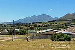
Raithby
Populated places in the Stellenbosch Local MunicipalityWestern Cape geography stubs
Raithby is a village in the Stellenbosch Local Municipality. As of the 2011 census, the village had a population of 908. It lies on the western side of the R44, just off the Winery Road that leaves the R44 to connect Stellenbosch with Firgrove. Amenities in Raithby include a Methodist church and a church-owned primary school.
Excerpt from the Wikipedia article Raithby (License: CC BY-SA 3.0, Authors).Raithby
Shaw Street, Stellenbosch Local Municipality Raithby
Geographical coordinates (GPS) Address Nearby Places Show on map
Geographical coordinates (GPS)
| Latitude | Longitude |
|---|---|
| N -34.022 ° | E 18.805 ° |
Address
Shaw Street
Shaw Street
Stellenbosch Local Municipality, Raithby
Western Cape, South Africa
Open on Google Maps


