place

Fiesso d'Artico

Cities and towns in VenetoMunicipalities of the Metropolitan City of VeniceVeneto geography stubs
Fiesso d artico Mairie 45.417002,12.03077

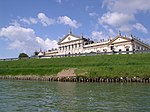
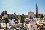
Fiesso d'Artico (Venetian: Fieso) is a town in the Metropolitan City of Venice, Veneto, Italy. The town is connected by the SR11, and is part of the Riviera del Brenta. Fiesso d'Artico has almost reached the remarkable age of one thousand years of official life: it is already mentioned, in fact, in documents dated 1025/1028. It is a village of 6.31 square kilometres (2.44 sq mi) (it has the smaller territory of the province of Venice) on the left bank of the Brenta river, halfway between Padua and Venice. Initially, the town was called just Fiesso, from the Latin Flexum, meaning a curve formed by the river anciently called the "Medoacus" (currently known as Brenta). The second name Artico was added later on, in honour of the lawyer Angelo Maria Artico, the creator of the last great deviation of the river which was necessary to safeguard the town from floods as the breaking of the levees by the river Brenta happened very often, before. In the past, this town was important as a religious center: it is recorded that a priest was appointed even by the bishop of Nicosia, in Cyprus, that was a dependence of the Republic of Venice, at the time. The territory was divided in two large parts inclusive of many other lands which nowadays belong to nearby municipalities, such as Dolo, Stra, Vigonza. Due to the short distance from Padua, Fiesso d'Artico was involved in many wars as a result of the struggle for the succession of several lordships in that city. Finally Fiesso d'Artico was included in the Republic of Venice, in the fifteenth century. Under the rule of the Republic of Venice, beautiful villas were built by the noble and rich Venetian merchants for their summer holidays and many of them still exist. Fiesso d'Artico was connected with Venice by a boat called the "Burchiello" through navigable river ways directly up to the Grand Canal. The citizens of Fiesso took an active role in the struggles for the independence of Veneto from the Austro-Hungarian Empire, as well as those for the liberation of Italy from Nazi-fascism during World War II. Fiesso d'Artico is still now one of the most charming views of the Riviera del Brenta, an area known throughout the world for its beauty and richness of art. Also it is known for shoes production, particularly for women. A high percentage of citizens of Fiesso d'Artico, in fact, is engaged in this production sector which is very known abroad. This sector has grown very much, taking the characteristics of quality and style appreciated internationally. Today there are about 200 shoe-manufacturing units of which 100 are involved in the proper construction of shoes, while the remaining ones are engaged in activities somehow related to the footwear industry.

Excerpt from the Wikipedia article Fiesso d'Artico (License: CC BY-SA 3.0, Authors, Images).

Fiesso d'Artico
Via Riviera del Brenta,

Geographical coordinates (GPS) Address Nearby Places
placeShow on map

Wikipedia: Fiesso d'ArticoContinue reading on Wikipedia

Geographical coordinates (GPS)

Latitude Longitude
N 45.416666666667 ° E 12.033333333333 °
placeShow on map

Address

Via Riviera del Brenta

Via Riviera del Brenta
30032
Veneto, Italy
mapOpen on Google Maps

Fiesso d artico Mairie 45.417002,12.03077
Share experience

Nearby Places

Riviera del Brenta
Riviera del Brenta

The Riviera del Brenta is an area of the Metropolitan City of Venice of particular tourist-cultural interest due to the great architectural heritage of the Venetian villas built between the 15th and 18th centuries by the nobles of the Venetian Republic along the river Brenta (now Naviglio del Brenta). This territory is the natural way of communication (by land or by river) between two large cities, Padua and Venice, and then over the centuries has become the holiday resort of wealthy patrons coming from the two capitals. Driving along the Brenta Canal starting from Padua, the cities that are part of the Brenta Riviera are Stra, Fiesso d'Artico, Dolo, Mira, Oriago, Malcontenta and Fusina. The "Naviglio" is navigable by riverboats, whose best example is the famous burchiello, which once used to carry Venetian noblemen from Venice to the countryside and Padua, and which is now a tourist attraction. On the territory of the Riviera del Brenta, in addition to the Venetian villas, the panoramic views along the Naviglio del Brenta, or the magnificent small villages that make up the historic centers of the Riviera itself, other attractions have arisen over the last century; for example, one of the most important centers for the development, design, and production of high fashion footwear was founded and developed. Along the main road that runs along the Riviera del Brenta, the famous Venice Marathon takes place once a year, in the month of October. The event takes place at the traditional distance of 42.195 km and starts from Stra (in front of the magnificent Villa Pisani) to end in the historic center of Venice.

Pianiga
Pianiga

Pianiga is a town in the Metropolitan City of Venice, Veneto, Italy. It is east of SR515. Pianiga is located in the extreme southwestern edge of the Metropolitan City of Venice, in part bordering on the province of Padua and in part with the municipalities of Santa Maria di Sala, Mirano, Mira, Dolo and Fiesso d'Artico. Up to the World War II the main occupation of the inhabitants was the agriculture which was conducted in accordance with local sharecroppers or tenants who worked the land of large landowners from Venice or Padua. From the World War II onwards and then more definitely from the years of economic boom several companies were established. Nowadays, the industries present within the municipal area of Pianiga are mostly engaged in building, metalworking and woodworking and in production of shoes and relevant accessories. There are also some other textile, glass processing and food processing industries. Economic development has generated a clear environmental transformation: the reduction of large tracts of cultivated fields corresponded to an increase in built-up areas; Pianiga got the appearance of a residential center while productive activities have been located in the closer precincts for example at Cazzago owing to the proximity of the rail station and highway exit and Mellaredo which is crossed by the state road connecting Padua to Treviso. Rivale is the least densely populated locality of the entire municipality, though, thanks to the establishment of a number of medium and large business, a high level of employment is available. Unfortunately, the initial urban development has grown spontaneously. The territory, which until a few years ago was used exclusively for farming, still enough recently was showing several examples of different types of country cottage, from mansions to the noble villas. In the past there were some rustic poor houses called the "casoni" (big houses) widespread in the territory which were hosting the families of laborers. Today none of them exist any longer at Pianiga, because they reminded the humiliating past of poverty, so nothing was done for their conservation and all them have been deteriorated by weather and lost forever.

Fossò
Fossò

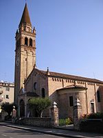
Fossò is a town and comune in the Metropolitan City of Venice, Veneto, Italy. It is west of SP13. The town of Fossò is located in a fertile plain in the territory of the Riviera del Brenta, between Padua and Venice. The name may be derived from the Latin " Fossadum ", a ditch, with reference probably to a minor line of river Brenta. An old sale contract shows that this town has existing at least since 1073 onwards with the consequent assumption that a church was already built here, though we must wait until 1130 to find the first sure mention of the existence of a chapel dedicated to St. Bartholomew, in a letter of the bishop of Padua. In 1761 a new church was dedicated to St. Bartholomew to replace the previous one. In 1797 Napoleon Bonaparte arrived in Italy and with the Treaty of Campo Formio, the glorious Republic of Venice ended forever. Under the role of the Napoleonic Kingdom of Italy, the municipalities of Fossò and Sandon were created in 1806 and assigned first to the current Province of Padua and then to the current Province of Venice, the year later. After World War II, Fossò had a good economic development, with the consequent urban expansion and substantial growth of the population, so that in 1957 it was necessary to build a new larger church. Nowadays, either the new and the old church, both dedicated to St. Bartholomew, are standing one opposite to the other on the main square of Fossò. The economical development transformed the town, once mostly agricultural, into a purely industrial and commercial place.