Silver Dollar Island
Colorado geography stubsIslands of ColoradoLandforms of Summit County, Colorado

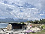
Silver Dollar Island is a small island in Summit County, Colorado. It is in the Blue River arm of the Dillon Reservoir, east of the Frisco Peninsula. Its coordinates are 39.5833199°N 106.0564078°W / 39.5833199; -106.0564078 (Silver Dollar Island) and it sits at an elevation of 2,750 meters. It appears on a 1970 USGS map of the area, along with Sentinel Island and Fishhook Island. The island is generally accessible by land via a small sand spit.
Excerpt from the Wikipedia article Silver Dollar Island (License: CC BY-SA 3.0, Authors, Images).Silver Dollar Island
Lakeshore Perimeter Trail,
Geographical coordinates (GPS) Address Nearby Places Show on map
Geographical coordinates (GPS)
| Latitude | Longitude |
|---|---|
| N 39.5833199 ° | E -106.0564078 ° |
Address
Lakeshore Perimeter Trail
Lakeshore Perimeter Trail
80443
Colorado, United States
Open on Google Maps


