Snake River (Colorado)
Colorado river stubsRivers of ColoradoRivers of Summit County, ColoradoTributaries of the Colorado River in Colorado

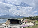
The Snake River is a short tributary of the Blue River, approximately 15 miles (24 km) long, in central Colorado in the United States. It drains a mountainous area on the west side of the Front Range in southeastern Summit County east of Keystone. It rises near the continental divide near Webster Pass along the Summit-Park county line and descends through a steep canyon to the north past the former mining camp of Montezuma, then turns west to flow past Keystone, where it joins the Blue from the east as an arm of Dillon Reservoir.
Excerpt from the Wikipedia article Snake River (Colorado) (License: CC BY-SA 3.0, Authors, Images).Snake River (Colorado)
Geographical coordinates (GPS) Address Nearby Places Show on map
Geographical coordinates (GPS)
| Latitude | Longitude |
|---|---|
| N 39.615277777778 ° | E -106.05416666667 ° |
Address
Silverthorne
80497
Colorado, United States
Open on Google Maps


