place

Holy Redeemer Church, York

Acomb, North YorkshireChurches completed in 1965Grade II listed churches in YorkUse British English from October 2020
Church of the Holy Redeemer, York

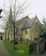
The Holy Redeemer Church lies on Boroughbridge Road, in the Acomb area of York, in England. The first church here was a simple brick building, completed in 1938. This is now used as the church hall, linked to the new church, behind. The new church was constructed between 1959 and 1965, to a design by George Pace.The church reuses parts of the demolished church of St Mary, Bishophill Senior. The south wall is constructed from stone from the building and includes Mediaeval windows, in a different arrangement to the original building. The remaining walls are brick, with the south wall including a 19th-century Gothic window. The clock tower is also of brick, and sits above a small chapel intended for weekday services.The church is entered through a late-12th century doorway. Inside, the church has a wide nave and two narrow aisles. The south arcade is from St Mary, partly dating from about 1200, and partly from the late 13th-century. Above the altar is an iron cross, incorporating an Anglo-Saxon carved stone. Other Saxon carved stones, mostly cross fragments, are incorporated in the pulpit and walls. The York Civic Trust claimed that these were "all the interesting parts" of St Mary.Nikolaus Pevsner described the building as "probably the best post-war building in the city". It was Grade II listed in 1998.

Excerpt from the Wikipedia article Holy Redeemer Church, York (License: CC BY-SA 3.0, Authors, Images).

Holy Redeemer Church, York
Boroughbridge Road, York Acomb

Geographical coordinates (GPS) Address External links Nearby Places
placeShow on map

Wikipedia: Holy Redeemer Church, YorkContinue reading on Wikipedia

Geographical coordinates (GPS)

Latitude Longitude
N 53.96611 ° E -1.12454 °
placeShow on map

Address

Church of the Holy Redeemer

Boroughbridge Road 108
YO26 6AB York, Acomb
England, United Kingdom
mapOpen on Google Maps

linkWikiData (Q26657146)
linkOpenStreetMap (170210135)

Church of the Holy Redeemer, York
Share experience

Nearby Places

St Stephen's Church, Acomb

St Stephen's Church is the parish church of Acomb, a suburb of York in England. A church has lain on the site since the Saxon period, and some remains of the Saxon church were uncovered in 1830. By the time of the Norman Conquest, it was a possession of York Minster. In 1228, it was transferred to the Treasurer of the Minster, and a vicarage was built in 1313. It was transferred to the Crown in 1547. By 1830, the church was ruinous, so from 1831 to 1832 it was rebuilt, to a design by G. T. Andrews. It seated 338 worshippers, partly in two galleries. Cruciform in plan, it was constructed in Tadcaster limestone with a slate roof. The original chancel was retained, but it was rebuilt in 1851. A vestry was added in 1889, and the following year, an east window was added. In the 20th-century, a porch was added, as was a lean-to on the north wall. In 1848, it was described as "an elegant structure with a graceful spire, and, standing on the highest ground in the vicinity of York, [it] has a very picturesque appearance". The Royal Commission on Historic Monuments was more critical, describing it as "ostensibly in the Early English style, [but it] shows no real appreciation of mediaeval architecture".The roof was rebuilt in 1952, and in 1954, a peal of bells was installed, cast in 1770 for St Mary Bishophill Senior. In 1983, the building was Grade II listed. The church suffered a fire in 1992 and was restored afterwards, but was restored soon afterwards, and many of its fixtures and fittings survived. These include stained glass, the oldest of which was made by Edmund Gyles in 1662, depicted the arms of Charles II of England. The arms of William IV are displayed on a panel in the porch.

Acomb, North Yorkshire

Acomb , is a village and suburb within the City of York unitary authority area, to the western side of York, England. It covers the site of the original village of the same name, which is mentioned in the Domesday Book of 1086. It is bordered by the suburbs of Holgate, to the east, Clifton, to the north and Woodthorpe to the south. The boundary to the west abuts the fields close to the A1237, York Outer Ring Road. Historically part of the West Riding of Yorkshire, Acomb was incorporated into the City of York in 1934.Formerly a farming village, Acomb expanded over the centuries to become a dormitory area for workers in heavy industry, such as rail engineering, in the 19th and 20th centuries and more recently for a more diverse workforce. Though it no longer has any large-scale manufacturing, it does have a diverse retail centre. There are at least 19 Grade II listed buildings within its boundaries. It was made a Conservation Area in 1975, with the historic area along Front Street and the Green retaining its village character. It is also an Area of Archaeological Importance under the Ancient Monuments and Archaeological Areas Act 1979. Acomb comprises two wards of the City of York: Acomb and Westfield. At the 2011 Census of England and Wales, it had a population of 22,215, the largest of all areas of the city. There are six primary schools and one comprehensive school. There are also a variety of sporting clubs and one public sports centre. Acomb is famous in York for having a very high concentration of street bollards. These were installed in an upgrade in 2023 and have since prompted great controversy among local residents due to their vast numbers and variance from the original proposed plans for the area.

York Cold War Bunker

The York Cold War Bunker is a two-storey, semi-subterranean, Cold War bunker in the Holgate area of York, England, built in 1961 to monitor nuclear explosions and fallout in Yorkshire, in the event of nuclear war. One of about 30 around the United Kingdom, the building was used throughout its operational existence as the regional headquarters and control centre for the Royal Observer Corps's No. 20 Group YORK between 1961 and 1991. It has become an English Heritage Scheduled Monument and was opened in 2006 by English Heritage as a tourist attraction. During its Cold War operational period, the building could have supported 60 local volunteer members of the Royal Observer Corps, inclusive of a ten-man United Kingdom Warning and Monitoring Organisation scientific warning team. They would have collated details of nuclear bombs exploded within the UK and tracked radioactive fallout across the Yorkshire region, warning the public of its approach. This example of an ROC control building is the only one that is preserved in its operational condition. The others stand derelict or have either been demolished or sold. A few have been converted to other uses, like No. 16 Group Shrewsbury that is now a veterinary clinic, another is a recording studio, two are satellite and communications control centres, and one is a solicitor's file storage facility. The fully restored building contains air filtration and generating plant, kitchen and canteen, dormitories, radio and landline communication equipment and specialist 1980s computers and a fully equipped operations room with vertical illuminated perspex maps.