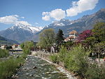
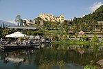
Lana, South Tyrol
Commons category link is locally definedMunicipalities of South TyrolNonsberg GroupPages with German IPAPages with Italian IPA

Lana (Italian pronunciation: [ˈlaːna]; German pronunciation: [ˈlaːna]) is a comune (municipality) and a village in South Tyrol in northern Italy. It is situated in the Etschtal (Etsch Valley) between Bolzano and Merano and at the entrance to the Ultental. The population rose to 12,566 in 2020. It is one of the three municipalities of South Tyrol whose name remained unchanged by the early 20th-century renaming programme which aimed at replacing mostly German place names with Italianised versions, the other two being Gais and Plaus.
Excerpt from the Wikipedia article Lana, South Tyrol (License: CC BY-SA 3.0, Authors, Images).Lana, South Tyrol
Spitalgasse - Vicolo Ospizio, Burggrafenamt - Burgraviato
Geographical coordinates (GPS) Address Nearby Places Show on map
Geographical coordinates (GPS)
| Latitude | Longitude |
|---|---|
| N 46.616666666667 ° | E 11.15 ° |
Address
Lorenzerhof
Spitalgasse - Vicolo Ospizio
39011 Burggrafenamt - Burgraviato, Oberlana - Lana di Sopra
Trentino-Alto Adige/Südtirol, Italy
Open on Google Maps


