Sault-au-Récollet
Ahuntsic-CartiervilleHeritage sites in Quebec (Cultural Heritage Act)Neighbourhoods in MontrealQuebec geography stubs

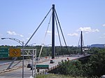
Sault-au-Récollet (Recollet Rapids, in English) is a neighbourhood in Montreal. It is located in the eastern edge of the borough of Ahuntsic-Cartierville bordering the Rivière des Prairies. Autoroute 19 connects Sault-au-Récollet to the city of Laval. The neighbourhood was designated as a heritage site by the city of Montreal in 1992.The Church of the Visitation at Sault-au-Récollet is the oldest church on the Island of Montreal, was built between 1749 and 1752. The Streetcar suburb was annexed by the former Montreal borough of Ahuntsic-Bordeaux in 1918. A housing boom, mostly made up of multiplexes, followed in the 1940s and 1950s.
Excerpt from the Wikipedia article Sault-au-Récollet (License: CC BY-SA 3.0, Authors, Images).Sault-au-Récollet
Rue Fleury Est, Montreal Ahuntsic-Cartierville
Geographical coordinates (GPS) Address Nearby Places Show on map
Geographical coordinates (GPS)
| Latitude | Longitude |
|---|---|
| N 45.57764 ° | E -73.64582 ° |
Address
Rue Fleury Est 2715
H2B 1K3 Montreal, Ahuntsic-Cartierville
Quebec, Canada
Open on Google Maps


