place

L'Île-de-la-Visitation Nature Park

Ahuntsic-CartiervilleMontréal-NordParks in MontrealUse Canadian English from December 2020
Canards au soleil couchant au parc nature de l'Île de la Visitation en septembre 2009

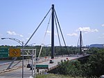
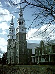
L'Île-de-la-Visitation Nature Park (French: Parc-nature de l'Île-de-la-Visitation) is a large nature park in the Ahuntsic-Cartierville and Montréal-Nord boroughs of Montreal, Quebec, Canada. Much of the park is on Île de la Visitation, with the rest being opposite the island on the shore of the Island of Montreal. Bridges connect the two sections. The park was established in 1984 during the renovation of the Rivière des Prairies generating station. It has an area of 34 hectares.The footpaths along the shore allow for walking and offer views of the Rivière des Prairies. The park has 8.8 kilometres (5.5 mi) of hiking trails and 3.6 kilometres (2.2 mi) of bike paths. Fishing is allowed in designated areas. Various historical monuments (Milling site, Maison du Pressoir, Maison du Meunier) and picnic tables are located along the trail. In winter, cross-country skiing trails are offered. There is also a small hill that is used for tobogganing by children. The current of the Rivière des Prairies is calm around the island.

Excerpt from the Wikipedia article L'Île-de-la-Visitation Nature Park (License: CC BY-SA 3.0, Authors, Images).

L'Île-de-la-Visitation Nature Park
Rue de L'Île-De-La-Visitation, Montreal Ahuntsic-Cartierville

Geographical coordinates (GPS) Address Nearby Places
placeShow on map

Wikipedia: L'Île-de-la-Visitation Nature ParkContinue reading on Wikipedia

Geographical coordinates (GPS)

Latitude Longitude
N 45.578 ° E -73.6617 °
placeShow on map

Address

Rue de L'Île-De-La-Visitation 2211
H2B 1W9 Montreal, Ahuntsic-Cartierville
Quebec, Canada
mapOpen on Google Maps

Canards au soleil couchant au parc nature de l'Île de la Visitation en septembre 2009
Share experience

Nearby Places

Greater Montreal
Greater Montreal

Greater Montreal (French: Grand Montréal) is the most populous metropolitan area in Quebec and the second most populous in Canada after Greater Toronto. In 2015, Statistics Canada identified Montreal's Census Metropolitan Area (CMA) as 4,258.31 square kilometres (1,644.14 sq mi) with a population of 4,027,100, almost half that of the province. A smaller area of 3,838 square kilometres (1,482 sq mi) is governed by the Montreal Metropolitan Community (MMC) (French: Communauté métropolitaine de Montréal, CMM). This level of government is headed by a president (currently Montreal mayor Valérie Plante). The inner ring is composed of densely populated municipalities located in close proximity to Downtown Montreal. It includes the entire Island of Montreal, Laval, and the Urban Agglomeration of Longueuil. Due to their proximity to Montreal's downtown core, some additional suburbs on the South Shore (Brossard, Saint-Lambert, and Boucherville) are usually included in the inner ring, despite their location on the mainland. The outer ring is composed of low-density municipalities located on the fringe of Metropolitan Montreal. Most of these cities and towns are semi-rural. Specifically, the term off-island suburbs refers to those suburbs that are located on the North Shore of the Mille-Îles River, those on the South Shore that were never included in the megacity of Longueuil, and those on the Vaudreuil-Soulanges Peninsula.