place

North–South Harbor Bridge

Asian bridge (structure) stubsBridges in ManilaPasig RiverPhilippine building and structure stubsProposed bridges in the Philippines

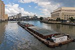
The North and South Harbor Bridge is an upcoming cable-stayed bridge that will connect Barangay 20 (Parola) in the North Harbor and Barangay 649 (Baseco Island) in the South Harbor of the Port of Manila. It will cross over the Pasig River and is parallel to the M. Roxas Jr. Bridge (Delpan Bridge). Civil works are expected to begin in 2021 and the bridge is scheduled to be completed and operational by 2023.

Excerpt from the Wikipedia article North–South Harbor Bridge (License: CC BY-SA 3.0, Authors).

North–South Harbor Bridge
Baseco Esplanade, Manila Port Area (Fifth District)

Geographical coordinates (GPS) Address Nearby Places
placeShow on map

Wikipedia: North–South Harbor BridgeContinue reading on Wikipedia

Geographical coordinates (GPS)

Latitude Longitude
N 14.594444444444 ° E 120.95555555556 °
placeShow on map

Address

Baseco Esplanade

Baseco Esplanade
1018 Manila, Port Area (Fifth District, Gawad Kalinga Habitat for Humanity Village)
Philippines
mapOpen on Google Maps

Share experience

Nearby Places

Pasig River
Pasig River

The Pasig River (Filipino: Ilog Pasig; Spanish: Río Pásig) is a water body in the Philippines that connects Laguna de Bay to Manila Bay. Stretching for 25.2 kilometers (15.7 mi), it bisects the Philippine capital of Manila and its surrounding urban area into northern and southern halves. Its major tributaries are the Marikina River and San Juan River. The total drainage basin of the Pasig River, including the basin of Laguna de Bay, covers 4,678 square kilometers (1,806 sq mi).The Pasig River is technically a tidal estuary, as the flow direction depends upon the water level difference between Manila Bay and Laguna de Bay. During the dry season, the water level in Laguna de Bay is low with the river's flow direction dependent on the tides. During the wet season, when the water level of Laguna de Bay is high, the flow is reversed towards Manila Bay. The Pasig River used to be an important transport route and source of water for Spanish Manila. Due to negligence and industrial development, the river suffered a rapid decline in the second half of the 20th century and was declared biologically dead in 1990. Two decades later after that declaration, however, a renaturation program designed to revive the river has seen the return of life to the river, including eight fish species, 39 species of birds, and 118 species of trees and other vegetation. As a result, the Pasig River received the Asian River Prize by the International River Foundation (IRF) in 2019.The Pasig River Rehabilitation Commission (PRRC) was a Philippine government agency established to oversee rehabilitation efforts for the river from 1999 until it was abolished in November 2019. Rehabilitation efforts are also aided by private sector organizations, such as the Clean and Green Foundation, Inc., which ran the Piso para sa Pasig (Filipino: "A peso for the Pasig") campaign in the 1990s.

Plaza de Armas (Manila)

The Plaza de Armas is a public square in Intramuros, Manila. The central plaza of Fort Santiago, it is one of three major plazas in Intramuros, the others being the central Plaza de Roma (also called "Plaza de Armas" at one point in its history) outside the fort grounds, and Plaza Moriones (not to be confused with Plaza Moriones in Tondo), a larger plaza outside Fort Santiago which was once a military promenade before it was closed in the 1863 earthquake that devastated Manila. While Plaza Moriones is outside the walls of Fort Santiago, both plazas are often misconstrued for the other.Historical evidence may suggest that the plaza is the site where the wooden palisade of Rajah Sulayman, on top of which Fort Santiago was built, was located, and was deliberately allocated by Miguel López de Legazpi as the smaller of two open squares in Intramuros, the other being the larger Plaza Mayor (today's Plaza de Roma). Military barracks and storehouses surrounded the plaza, the ruins of which stand today.Currently, the plaza is an open green area surrounded by trees. At the western side of the plaza is the Rizal Shrine, erected in honor of José Rizal, who was imprisoned there prior to his execution in 1896, when the building was still being used as military barracks. The Shrine includes a statue of Rizal which was erected at the center of the plaza. To the north is a cross erected in memory of World War II victims who were buried in a mass grave underneath by the Imperial Japanese Army, while the eastern side contains an eighteenth-century building which was converted into the Dulaang Raha Sulayman (Rajah Sulayman Theater), the venue of seasonal performances by the Philippine Educational Theater Association (PETA).