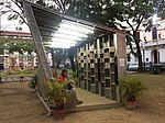
Port Area, Manila
Districts of ManilaPort Area, ManilaUse Philippine English from November 2022Use mdy dates from December 2020

The Port Area is a district of the city of Manila, Philippines. It is entirely a reclaimed land occupied by Manila South Harbor and Baseco Compound. It is bounded on the north by the Pasig River, facing the districts of Tondo and San Nicolas, on the west by Manila Bay, on the east by Intramuros, separated by Radial Road 1, and on the south by Ermita. Post-war developments at the Manila South Harbor eventually paved the way for the migration of people from the different provinces, making it one of the largest urban poor community in the Philippines.
Excerpt from the Wikipedia article Port Area, Manila (License: CC BY-SA 3.0, Authors, Images).Port Area, Manila
A. C. Delgado Street, Manila Port Area (Fifth District)
Geographical coordinates (GPS) Address Nearby Places Show on map
Geographical coordinates (GPS)
| Latitude | Longitude |
|---|---|
| N 14.588726 ° | E 120.968597 ° |
Address
BPI
A. C. Delgado Street
1018 Manila, Port Area (Fifth District)
Philippines
Open on Google Maps


