Wasseramt District
Districts of the canton of Solothurn

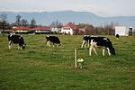
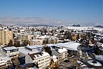
Wasseramt District is one of the ten districts of the canton of Solothurn in Switzerland, situated to the south of the canton. Together with the Bucheggberg District, it forms the Amtei (electoral district) of Wasseramt-Bucheggberg. It has a population of 52,949 (as of 31 December 2020).
Excerpt from the Wikipedia article Wasseramt District (License: CC BY-SA 3.0, Authors, Images).Wasseramt District
Recherswilstrasse, Bezirk Wasseramt
Geographical coordinates (GPS) Address Nearby Places Show on map
Geographical coordinates (GPS)
| Latitude | Longitude |
|---|---|
| N 47.166666666667 ° | E 7.5833333333333 ° |
Address
Recherswilstrasse
Recherswilstrasse
4564 Bezirk Wasseramt
Solothurn, Switzerland
Open on Google Maps


