Shetucket River

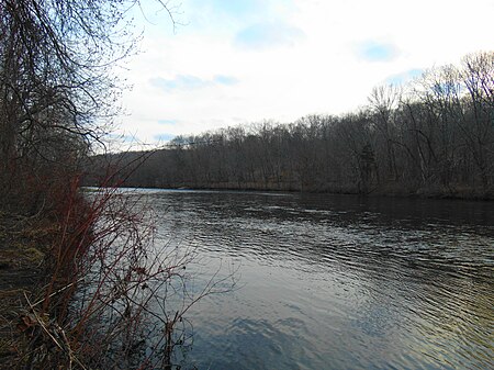
The Shetucket River is a tributary of the Thames River, 20.4 miles (32.8 km) long, in eastern Connecticut in the United States. It is formed at Willimantic by the junction of the Willimantic and Natchaug rivers. It flows southeast and south. Approximately 4 miles (6 km) northeast of Norwich it receives the Quinebaug River and broadens into a wide estuary which stretches southeast for approximately 5 miles (8 km) and joins the Thames estuary on the south side of Norwich. The river flows through a rural section of New England, despite the historical presence of industry in the surrounding region. Parts of the rivers have been designated by the federal government as the Quinebaug and Shetucket Rivers Valley National Heritage Corridor. The National Park Service describes the river valley as the "last green valley" in the Boston-to-Washington megalopolis. In nighttime satellite photos, the valley appears distinctively dark amidst the lights of the surrounding urban and suburban regions.
Excerpt from the Wikipedia article Shetucket River (License: CC BY-SA 3.0, Authors, Images).Shetucket River
Chelsea Harbor Drive, Norwich
Geographical coordinates (GPS) Address Website Nearby Places Show on map
Geographical coordinates (GPS)
| Latitude | Longitude |
|---|---|
| N 41.522222222222 ° | E -72.077777777778 ° |
Address
Waterfront Public Parking
Chelsea Harbor Drive 105
06360 Norwich
Connecticut, United States
Open on Google Maps


