place

Queensbridge Park

1939 establishments in New York CityLong Island CityParks in Queens, New YorkUrban public parks
Queensbridge Park Path

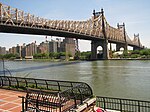
Queensbridge Park, named for the nearby Queensboro Bridge, is a 20.34-acre (8.23 ha) city park along the East River in Long Island City, Queens, New York City. The park is a primary place of recreation for residents of Queensbridge Houses and has a riverfront promenade, baseball diamonds, running paths, lawns and areas for picnicking.

Excerpt from the Wikipedia article Queensbridge Park (License: CC BY-SA 3.0, Authors, Images).

Queensbridge Park
Vernon Boulevard, New York Queens

Geographical coordinates (GPS) Address Nearby Places
placeShow on map

Wikipedia: Queensbridge ParkContinue reading on Wikipedia

Geographical coordinates (GPS)

Latitude Longitude
N 40.756388888889 ° E -73.948888888889 °
placeShow on map

Address

Vernon Boulevard

Vernon Boulevard
10044 New York, Queens
New York, United States
mapOpen on Google Maps

Queensbridge Park Path
Share experience

Nearby Places

Roosevelt Island station

The Roosevelt Island station is a station on the IND 63rd Street Line of the New York City Subway. Located in Manhattan on Roosevelt Island in the East River, it is served by the F train at all times and the train during rush hours in the reverse peak direction. The Roosevelt Island station was first proposed in 1965, when the New York City Transit Authority (NYCTA) announced that it would build a subway station to encourage transit-oriented development on Roosevelt Island. The station and the rest of the 63rd Street Line were built as part of the Program for Action, a wide-ranging subway expansion program, starting in the late 1960s. When construction of the line was delayed, the Roosevelt Island Tram was built in 1973. The Roosevelt Island Operating Corporation was formed in 1984 to develop the island, but was not successful until October 1989 when the subway station opened along with the rest of the 63rd Street Line. The opening encouraged the development of the island, which has made the station busier. Until December 2001, this was the second-to-last stop of the line, which terminated one stop east at 21st Street–Queensbridge. In 2001, the 63rd Street Tunnel Connection opened, allowing trains from the IND Queens Boulevard Line to use the line. Since the opening of the connection, the line has been served by F trains, and the subway then became the second means for direct travel between the island and Queens, supplementing the buses that had been operating over the Roosevelt Island Bridge. The station is one of the system's deepest, at 100 feet (30 m) below ground, because the line passes under the West and East Channels of the East River at either end of the station.

Roosevelt Island
Roosevelt Island

Roosevelt Island is an island in New York City's East River, within the borough of Manhattan. It lies between Manhattan Island to the west, and the borough of Queens, on Long Island, to the east. Running from the equivalent of East 46th to 85th Streets on Manhattan Island, it is about 2 miles (3.2 km) long, with a maximum width of 800 feet (240 m), and a total area of 147 acres (0.59 km2). Together with Mill Rock, Roosevelt Island constitutes Manhattan's Census Tract 238, which has a land area of 0.279 sq mi (0.72 km2), and had a population of 11,722 as of the 2020 United States Census.Lying below the Queensboro Bridge, the island cannot be accessed directly from the bridge itself. Vehicular traffic uses the Roosevelt Island Bridge to access the island from Astoria, Queens, though the island is not designed for vehicular traffic and has several areas designed as car-free zones. Several public transportation options to reach the island exist. The Roosevelt Island Tramway, the oldest urban commuter tramway in the U.S, connects the island to Manhattan Island's Upper East Side. The Roosevelt Island station carries the F and trains of the New York City Subway. The NYC Ferry also maintains a dock on the east side of the island. On-island transport is provided by the Red Bus service. The island was called Minnehanonck by the Lenape and Varkens Eylandt (Hog Island) by the Dutch during the colonial era and later Blackwell's Island. It was known as Welfare Island when it was used principally for hospitals, from 1921 to 1973. It was renamed Roosevelt Island (in honor of Franklin D. Roosevelt) in 1973.Roosevelt Island is owned by the city but was leased to the New York State Urban Development Corporation for 99 years in 1969. Most of the residential buildings on Roosevelt Island are rental buildings. There is also a cooperative named Rivercross and a condominium building named Riverwalk. One rental building (Eastwood) has left New York State's Mitchell-Lama Housing Program, though current residents are still protected. It is now called Roosevelt Landings. There are attempts to privatize three other buildings, including the cooperative. The New York City Fire Department also maintains its Special Operations Command facility at 750 Main St. on the island.

63rd Street Tunnel
63rd Street Tunnel

The 63rd Street Tunnel is a double-deck subway and railroad tunnel under the East River between the boroughs of Manhattan and Queens in New York City. Opened in 1989, it is the newest of the East River tunnels, as well as the newest rail river crossing in the New York metropolitan area. The upper level of the 63rd Street Tunnel carries the IND 63rd Street Line of the New York City Subway. As of 2021, the tunnel's lower level has never been used for passenger service, but is expected to carry Long Island Rail Road (LIRR) trains to a new train terminal under Grand Central Terminal, following the completion of the East Side Access project, scheduled for 2022. Construction of the 63rd Street Tunnel began in 1969, and the tunnel was holed through beneath Roosevelt Island in 1972. Completion of the tunnel and its connections was delayed by the 1975 New York City fiscal crisis and the upper level was not opened until 1989, twenty years after construction started. The lower level was not opened at that time because of the cancellation of the LIRR route to Manhattan. The tunnel was initially referred to as the "tunnel to nowhere" because its Queens end did not connect to any other subway line until 2001. Construction on the East Side Access project, which will incorporate the lower level, started in 2006. During construction, the lower level is being used to move materials between the work sites in Manhattan and staging areas in Queens.