place

Mongmong-Toto-Maite, Guam

Guam geography stubsVillages in Guam
Mongmong Toto Maite, Guam

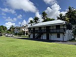
Mongmong-Toto-Maite (Chamorro: Mong Mong-Totu-Maiti) is a municipality in the United States territory of Guam composed of three separate villages east of Hagåtña that experienced development after the Second World War. Mongmong is adjacent to the Hagåtña Swamp; Toto is situated to the north-east near Barrigada; Maite is located on the cliffs overlooking Agana Bay and the Philippine Sea. The village's population has decreased since the island's 2010 census.

Excerpt from the Wikipedia article Mongmong-Toto-Maite, Guam (License: CC BY-SA 3.0, Authors, Images).

Mongmong-Toto-Maite, Guam
S-15,

Geographical coordinates (GPS) Address Nearby Places
placeShow on map

Wikipedia: Mongmong-Toto-Maite, GuamContinue reading on Wikipedia

Geographical coordinates (GPS)

Latitude Longitude
N 13.471944444444 ° E 144.77027777778 °
placeShow on map

Address

S-15 169
96910
Guam, United States
mapOpen on Google Maps

Mongmong Toto Maite, Guam
Share experience

Nearby Places

Agana Historic District

The Agana Historic District in Hagåtña (formerly Agana), Guam is a 2-acre (0.81 ha) historic district that was listed on the U.S. National Register of Historic Places in 1985. It includes five contributing buildings: the Calvo-Torres, Rosario, Martinez-Notley, Lujan and Leon Guerrero houses. The area is roughly bounded by 2nd S., 3rd S., and 9th W., Santa Cruz and Legaspi Sts. in Agana. The Calvo-Torres and Martinez-Notley houses are the oldest surviving private residences in Guam. The set of structures are Guam's oldest concrete buildings. And the set is the only surviving group of pre-World War II houses in Agana, "the only fragment left of old Agana's urban space." While a few scattered other individual structures survive, all else has been destroyed by World War II, termites, typhoons Karen of 1962 and Pamela of 1976, and other causes. They are also significant for tie to the Spanish colonial era and the use of ifil wood prior to Guam's deforestation.: 3  The Calvo-Torres House is the oldest, with its oldest part dating about 1800. It is approximately 16.6 by 17.6 metres (54 ft × 58 ft) in plan, has ifil framing, and is roofed by original Spanish tile plus later metal roofing. The oldest part, built of manposteria (coral mixed with lime mortar), once hosted a silversmith. A kitchen was added, and, in the 1920s, a concrete addition. The Rosario House is believed to have been built in the late 1800s. It is a 8.8 by 11.3 metres (29 ft × 37 ft) south-facing "one-and-a-half bodega type" structure.: 6  Part of the Martinez-Notley House was built in 1826. William H. Notley married into the Martinez family. The house is 20.9 by 15.5 metres (69 ft × 51 ft). It is described as having massing and overall character with "strong Spanish overtones"; it is largely surrounded by manposteria walls.: 6–7  The Leon Guerrero House is a 17.7-by-12-metre (58 ft × 39 ft) house started in 1939 but halted by rumors of war, then used as barracks by Japanese personnel during the war, with storage of rice in its lower level. It would have been destroyed after the war but its owner, Leon Guerrero, refused to vacate.: 7  The Lujan House is separately listed on the National Register as Guam Institute.: 7