place

Spotswood, Victoria

Suburbs of MelbourneSuburbs of the City of Hobsons BayUse Australian English from August 2019
Spotswood2
Spotswood2

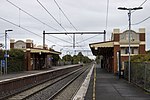
Spotswood is an inner-city suburb in Melbourne, Victoria, Australia, 7 km (4.3 mi) south-west of Melbourne's Central Business District, located within the City of Hobsons Bay local government area. Spotswood recorded a population of 2,820 at the 2021 census.The suburb is bounded by the Newport–Sunshine freight railway line in the west, the West Gate Freeway in the north, the Yarra River in the east and by Burleigh Street in the south. Spotswood was named after John Stewart Spotswood, one of the first farmers who owned much of the area in the 1840s.Many people think he was born Spottiswoode due to the name of the Spottiswoode Hotel which still stands, but his birth records confirm his name was always spelled Spotswood.

Excerpt from the Wikipedia article Spotswood, Victoria (License: CC BY-SA 3.0, Authors, Images).

Spotswood, Victoria
Hall Street, Melbourne Spotswood

Geographical coordinates (GPS) Address Nearby Places
placeShow on map

Wikipedia: Spotswood, VictoriaContinue reading on Wikipedia

Geographical coordinates (GPS)

Latitude Longitude
N -37.831 ° E 144.887 °
placeShow on map

Address

Hall Street 176
3015 Melbourne, Spotswood
Victoria, Australia
mapOpen on Google Maps

Spotswood2
Spotswood2
Share experience

Nearby Places

Yarraville Oval
Yarraville Oval

The Yarraville Oval is an Australian rules football and cricket ground located on the corner of Williamstown Road and Anderson Street in Yarraville, Victoria. It is currently the home ground of the Yarraville/Seddon Eagles Football Club and the Yarraville Cricket Club. The ground was most notable as the home of the Yarraville Football Club throughout almost its entire existence in both the Victorian Junior Football Association from 1903 until 1927, and then in the Victorian Football Association from 1928 until 1982; the club played its games at the Western Oval in its final season in 1983. The ground was originally managed by a group of trustees, but management of the ground was transferred to the Footscray Council in 1928 to enable the ground to be upgraded to Association standards. The City of Maribyrnong, which incorporates the former City of Footscray, remains the ground manager.In 1942, Yarraville Oval was the home of the Footscray Football Club in the Victorian Football League because its normal home ground, the Western Oval, was being used as an army base, whilst the VFA was in recess until 1945. The Western Region Football League had its head office at the Oval until 2010. A ground record crowd estimated to be between 16,000 and 18,000 attended Ron Todd's first VFA match for Williamstown, played against Yarraville on 20 April 1940. The record crowd for a VFL game was set on 25 July 1942 when 15,000 fans turned out to see Footscray defeat eventual grand finalist Richmond by seven points in a high-scoring game.One of the most noticeable features of the Yarraville Oval is the historic W. Pedley Stand. The grandstand was built in two sections and has a unique V shape: the southern half of the stand was built in 1929, and the northern half was built in 1940. The viewing area of the grandstand was damaged by fire in 2017.