place

Glenridding

PatterdaleUse British English from September 2019Villages in Cumbria
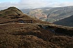
Glenridding, Cumbria, England June 2009

Glenridding is a village at the southern end of Ullswater, in the English Lake District. The village is popular with mountain walkers who can scale England's third-highest mountain, Helvellyn, and many other challenging peaks from there.

Excerpt from the Wikipedia article Glenridding (License: CC BY-SA 3.0, Authors, Images).

Glenridding
Greenside Road,

Geographical coordinates (GPS) Address Nearby Places
placeShow on map

Wikipedia: GlenriddingContinue reading on Wikipedia

Geographical coordinates (GPS)

Latitude Longitude
N 54.544 ° E -2.953 °
placeShow on map

Address

Greenside Road

Greenside Road
CA11 0QG
England, United Kingdom
mapOpen on Google Maps

Glenridding, Cumbria, England June 2009
Share experience

Nearby Places

Patterdale
Patterdale

Patterdale (Saint Patrick's Dale) is a small village and civil parish in the eastern part of the English Lake District in Cumbria, in the traditional county of Westmorland, and the long valley in which they are found, also called the Ullswater Valley. The parish had a population of 460 in 2001, increasing to 501 at the 2011 Census. The poet William Wordsworth lived in youth near Patterdale and his autobiographical poem The Prelude narrates in Book 1 such childhood activities as fishing in the lake from a stolen boat. The village is now the start point for a number of popular hill-walks, most notably the Striding Edge path up to Helvellyn. Other fells that can be reached from the valley include Place Fell, High Street, Glenridding Dodd, most of the peaks in the Helvellyn range, Fairfield and St Sunday Crag, and Red Screes and Stony Cove Pike at the very end of the valley, standing either side of the Kirkstone Pass which is the road to Ambleside. Further up the valley to the north is the lake of Ullswater with Gowbarrow Fell and Hallin Fell overlooking it. The only tarn in the valley is Brothers Water, one of the first places in the Lakes to be acquired by the National Trust. The only other village in the valley is Glenridding. Patterdale village has a youth hostel, a church, a primary school and a hotel. In summer it can get quite busy, but not so much as Glenridding. Patterdale is considered to be a walkers' valley, and in fact Alfred Wainwright stated that it was his favourite valley in the Lake District as it is relatively undisturbed by tourism. Alongside Glenridding, Patterdale was also badly affected by Storm Desmond in December 2015.

Greenside Mine
Greenside Mine

Greenside Mine (sometimes referred to as Greenside Lead Mine) was a successful lead mine in the Lake District of England. Between 1825 and 1961 the mine produced 156,000 long tons (159,000 tonnes) of lead and 1,600,000 ounces (45 tonnes) of silver, from around 2 million tons of ore. During the 1940s it was the largest producer of lead ore in the UK. Unusually for a 19th-century metalliferous mine in Britain there are very full records of its activities, dating back to 1825. The mine probably opened during the second half of the 1700s but had closed by 1819. In 1825 the Greenside Mining Company was formed and reopened the mine. They made good profits until 1880, when the price of lead fell. Many other lead mines closed at that time, but the company reduced its costs and continued to work Greenside until 1935. Electricity was introduced to the mine in the 1890s, and it became the first metalliferous mine in Britain to use electric winding engines and an electric locomotive. In 1936 the Basinghall Mining Syndicate Ltd. acquired the mine and turned it into a high volume lead producer. The mine closed in 1962 after lead reserves had been exhausted. Just before it closed the mine was used by the Atomic Weapons Research Establishment (AWRE) to conduct an experiment in detecting seismic signals from underground explosions. Fifteen years after the mine closed mine explorers began to visit the upper levels. They cleared the entrances and several roof falls, and today they are able to pass through the mine using an old escape route. All the ore produced by the mine came from the Greenside Vein, a mineral vein which filled a geological fault running in a north–south direction through the east ridge of Green Side, a mountain in the Helvellyn range. Mining activities traced this fault for a length of 3,900 feet (1,200 m) and to a depth of 2,900 feet (880 m). Four areas of the vein, known as ore shoots, contained galena, an ore of lead which also contained small amounts of silver. At first the ore was mined simply by driving adits into the mountain-side. To access ore at greater depths, two longer levels were driven from lower down but further away, and then a series of shafts were sunk within the mine. The lowest point in the mine was roughly 100 m below sea level, where the surrounding andesite rock rested upon underlying shales in which the fault had not been mineralised. Two processing mills were built to crush the ore and separate out the galena from it, and the mine had its own smelt mill between 1828 and 1917, but after that it was more economical to sell concentrated galena to a commercial smelter. Machinery in the mine and the mills was powered by the plentiful water supplies in the area, used to drive water wheels and power hydraulic engines, and, after 1890, to generate hydroelectricity. Dozens of carts transported supplies to the mine's remote location, and carried the lead out. In the early 1900s the mine set up its own road haulage business using two steam wagons. The men who worked at the mine during the 19th century travelled from a wide area, and many stayed each week in the lodging shops (bunkhouses) built at the mine. In time the company built dozens of houses in Glenridding and at Seldom Seen in Glencoynedale where a school was also built. Mining work was carried out by groups of men who took contracts to do specific jobs, and were paid by their results. Those who worked transporting ore out of the mine or processing the ore were paid at weekly rates. The closure of the mine resulted in a major loss of employment in the area.

Brothers Water
Brothers Water

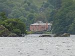
Brothers Water is a small lake in the Hartsop valley, in the eastern region of the Lake District in England. Once called Broad Water, it lies at the northern end of Kirkstone Pass, affording views on the descent towards Patterdale. The name was changed in the 19th century after two brothers drowned there. Dorothy Wordsworth, having left William Wordsworth sitting on Cow Bridge, walked beside the lake on 16 April 1802, commented on: ...the boughs of the bare old trees, the simplicity of the mountains, and the exquisite beauty of the path...the gentle flowing of the stream, the glittering, lively lake, green fields without a living creature to be seen on them. The lake is not among the most popular in the national park, being shallow and full of reeds. Water lilies bloom in July, providing colour. To the north-east of Brothers Water is the village of Hartsop, which has several 17th-century stone farm buildings and cottages. Some of the buildings still contain spinning-rooms where villagers would have made their own clothing, selling any surplus in the local market towns. The word Hartsop means "valley of the deer", which would have lived in the woodlands of the lower areas of the surrounding fells. A walk through woodland skirts the western shore. From its northern end the walk leads to Patterdale. Southward it heads over Kirkstone Pass to Ambleside. On the western side of Brothers Water is Hartsop Hall. The 16th-century building passed to Sir John Lowther in the 17th century and is now owned by the National Trust. The village of Hartsop lies near the northeast corner of the lake. Brothers Water may be classified in either of two ways: as one of the Lake District's smallest lakes or one of its largest tarns. The lake is home to a trout population and harbours a rare species of fish, the schelly.