place

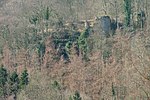
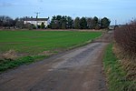
Pinkney and Gerrick Woods

English Site of Special Scientific Interest stubsForests and woodlands of North YorkshireLoftus, North YorkshireRedcar and Cleveland geography stubsSites of Special Scientific Interest in Cleveland, England
Sites of Special Scientific Interest notified in 1954Use British English from September 2021

Pinkney And Gerrick Woods (grid reference NZ708138) is a 62.7 hectare biological Site of Special Scientific Interest in North Yorkshire, England notified in 1954. SSSIs are designated by Natural England, formally English Nature, which uses the 1974–1996 county system. This means there is no grouping of SSSIs by Redcar and Cleveland unitary authority, or North Yorkshire which is the relevant ceremonial county. As such Pinkney and Gerrick Woods is one of 18 SSSIs in the Cleveland area of search.

Excerpt from the Wikipedia article Pinkney and Gerrick Woods (License: CC BY-SA 3.0, Authors).

Pinkney and Gerrick Woods

Geographical coordinates (GPS) Address Nearby Places
placeShow on map

Wikipedia: Pinkney and Gerrick WoodsContinue reading on Wikipedia

Geographical coordinates (GPS)

Latitude Longitude
N 54.515 ° E -0.90555555555556 °
placeShow on map

Address

Liverton Moor


TS13 4TJ
England, United Kingdom
mapOpen on Google Maps

Share experience

Nearby Places

Moorsholm
Moorsholm

Moorsholm is a village in the unitary authority of Redcar and Cleveland and the ceremonial county of North Yorkshire, England. The village lies 5 miles (8 km) from Saltburn-by-the-Sea between the North York Moors and the North Sea. Because of its proximity to the North Sea coast the area was vulnerable, historically, to attack by invaders from Scandinavia. The name of Moorsholm is of Viking origin with the suffix holm, which meant a settlement, being affixed to the location of the village by the moors: so meaning settlement by the moors. The village used to be called Great Moorsholm to distinguish it from a farm called Little Moorsholm, which is the other side of the Hagg Beck Valley to the north. 'Little Moorsholm' is a title now more commonly applied to a more modern housing estate between that farm and Lingdale. The settlement was mentioned in the Domesday book as Morehusum, belonging to the Earl of Morton and later Clan Bruce, ancestor to the kings of Scotland, and from them descended to the Thwengs, Lumleys, and others. It was a planned mediaeval village built along a main street with crofts and their associated tofts on each side. The church of St Mary, Moorsholm, was built in 1892 and is of stone in 12th-century style. It consists of chancel, nave and west tower.The Memorial Hall was built as a war memorial in 1957 and is used as the doctors’ surgery and meeting room.About 1 mile (1.6 km) to the south of Moorsholm is the landmark of Freebrough Hill, a detached natural hill which is a left over glacial drumlin a relic from the last ice age. This explains its unusual conical shape.