Liverton

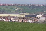
Liverton is a village in the civil parish of Loftus, in the borough of Redcar and Cleveland and the ceremonial county of North Yorkshire, England.Liverton Village is named in the Doomsday Book and was previously named Liureton, it is a rural village that has by-enlarge retained its heritage as a farming community and in 1978 became protected by a conservation order. In 2011 an Area Appraisal was performed.The village is surrounded by a field system with Station Road B1366 running through the middle. The village can date its roots back to the 12th century, with evidence of this seen from the font, arch and doorway of St Michaels church. There is further evidence of a medieval settlement in area. It is located 140 meters above sea level and is located on the edge of the North Yorkshire Moors.
Excerpt from the Wikipedia article Liverton (License: CC BY-SA 3.0, Authors, Images).Liverton
Liverton Road,
Geographical coordinates (GPS) Address Nearby Places Show on map
Geographical coordinates (GPS)
| Latitude | Longitude |
|---|---|
| N 54.533 ° | E -0.902 ° |
Address
Liverton Road
Liverton Road
TS13 4TD
England, United Kingdom
Open on Google Maps


