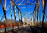
Foul Rift
Belvidere, New JerseyDelaware RiverLandforms of New JerseyNew Jersey geography stubsRapids of the United States
Foul Rift is a Class II rapids in the Delaware River from mile 196.3 to 196.7, located about a mile south of Belvidere, New Jersey. The rapids are caused by a 22-foot descent in elevation of the limestone ledge riverbed for approximately 0.5 miles, and are considered to be the most dangerous on the Delaware River. At elevated water levels some of the narrower rapids can become extremely dangerous.
Excerpt from the Wikipedia article Foul Rift (License: CC BY-SA 3.0, Authors).Foul Rift
Foul Rift Road, White Township
Geographical coordinates (GPS) Address Nearby Places Show on map
Geographical coordinates (GPS)
| Latitude | Longitude |
|---|---|
| N 40.8074 ° | E -75.1 ° |
Address
Foul Rift Road
Foul Rift Road
07823 White Township
New Jersey, United States
Open on Google Maps


