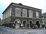
Dolgellau
Communities in GwyneddCounty towns in WalesDolgellauPages including recorded pronunciationsPages with English IPA ... and 4 more
Pages with Welsh IPAPages with plain IPATowns in GwyneddUse British English from March 2015

Dolgellau (/dɒlˈɡɛθlaɪ/; Welsh pronunciation: [dɒlˈɡɛhlaɪ]; also [dɔlˈɡɛɬaɨ] ) is a town and community in Gwynedd, north-west Wales, lying on the River Wnion, a tributary of the River Mawddach. It was the traditional county town of the historic county of Merionethshire until the county of Gwynedd was created in 1974. Dolgellau is the main base for climbers of Cadair Idris and Mynydd Moel which are visible from the town. Dolgellau is the second largest settlement in southern Gwynedd after Tywyn and includes the community of Penmaenpool.
Excerpt from the Wikipedia article Dolgellau (License: CC BY-SA 3.0, Authors, Images).Dolgellau
Eldon Square,
Geographical coordinates (GPS) Address Nearby Places Show on map
Geographical coordinates (GPS)
| Latitude | Longitude |
|---|---|
| N 52.743055555556 ° | E -3.8855555555556 ° |
Address
Eldon Square
Eldon Square
LL40 1AL , Dolgellau
Wales, United Kingdom
Open on Google Maps


