place

Fairfield, Liverpool

Areas of LiverpoolMerseyside geography stubsVague or ambiguous time from January 2018
Fairfield, Liverpool Sign

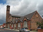
Fairfield is an area of Liverpool, in Merseyside, England, encompassing streets between Tuebrook and Kensington and stretching to Old Swan. It consists of a variety of houses; there are some traditional red-brick terraces, larger Victorian villas and also the notable 300-year-old Georgian Fairfield Crescent which is off the equally old Prospect Vale. The area also contains the Victorian Newsham Park; Friends of Newsham Park meet with council officers regularly at the Newsham Park park forum to discuss improvements to the park and are currently anticipating the start on site of the building of a new pavilion. Fairfield is now also home to a new shopping development on Prescot Road, which brings retail stores like Iceland and other shops into this once neglected neighbourhood centre. Another new facility is the community fire station on Beech Street which was opened in 2010 by the Duchess of Gloucester. It has been named "Kensington" Fire Station, despite being just inside the Fairfield border. Fairfield is paired with Kensington to form a Liverpool City Council Ward. The district is primarily residential although a few industrial estate roads exist.

Excerpt from the Wikipedia article Fairfield, Liverpool (License: CC BY-SA 3.0, Authors, Images).

Fairfield, Liverpool
Innovation Boulevard, Liverpool Wavertree

Geographical coordinates (GPS) Address Nearby Places
placeShow on map

Wikipedia: Fairfield, LiverpoolContinue reading on Wikipedia

Geographical coordinates (GPS)

Latitude Longitude
N 53.404 ° E -2.935 °
placeShow on map

Address

Nutricia Staff

Innovation Boulevard
L7 9PA Liverpool, Wavertree
England, United Kingdom
mapOpen on Google Maps

Fairfield, Liverpool Sign
Share experience

Nearby Places

Wavertree Lane railway station

Wavertree Lane was one of the original stopping-places on the Liverpool & Manchester Railway which opened in 1830. Stopping-places were commonly located at supervised level crossings where gatekeepers were available to signal trains to stop close to the point at which the line crossed the road, in this case Wavertree Lane (now Wavertree Road). The stopping-places were generally primitive in nature without platform or shelter for passengers. Wavertree Lane appeared in the first official list of stopping-places issued in February 1831. The list was probably issued to reduce the number of informal intermediate stops requested by passengers. In the early days only second class trains made such request stops although mixed class trains were introduced subsequently. The stopping-place was close to Wavertree Hall, residence of Mr Charles Lawrence, chairman of the railway company. A short length of track was laid in the vicinity in Summer 1827, very early in construction of the line, presumably for demonstration and public relations purposes. However, the cuttings to the east and west appear to have been incomplete at the time of Thomas Telford's report in early 1829. On 14 June 1830 the locomotive Arrow took a train carrying directors of the company to Manchester. On the return the train terminated at Wavertree where they were given dinner at Wavertree Hall.The station was probably one of the first to have a company-owned building with a cottage across the road for the gatekeeper.The station closed to passengers in 1836 with the opening of the tunnel to Lime Street station from Edge Hill station (the latter was initially referred to in planning documents as New Wavertree Lane station). Ultimately the level crossing was replaced by a bridge and the area occupied by the station subsumed into industrial and railway development associated with the Edge Hill goods marshalling yards.