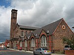
Wavertree
Areas of LiverpoolUse British English from February 2017

Wavertree is a district of Liverpool, England. It is a ward of Liverpool City Council, and its population at the 2011 census was 14,772. Located to the south and east of the city centre, it is bordered by various districts and suburbs such as Childwall, Edge Hill, Fairfield, Mossley Hill, Old Swan, and Toxteth.
Excerpt from the Wikipedia article Wavertree (License: CC BY-SA 3.0, Authors, Images).Wavertree
Bagot Street, Liverpool Wavertree
Geographical coordinates (GPS) Address Nearby Places Show on map
Geographical coordinates (GPS)
| Latitude | Longitude |
|---|---|
| N 53.398 ° | E -2.9337 ° |
Address
Bagot Street
Bagot Street
L15 0HT Liverpool, Wavertree
England, United Kingdom
Open on Google Maps


