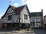
Taynton, Gloucestershire
Civil parishes in GloucestershireForest of DeanUse British English from October 2019Villages in Gloucestershire
Taynton is a village and civil parish in the Forest of Dean district of Gloucestershire, England. It lies about 2.5 miles (4.0 km) south-east of Newent, about 2 miles (3.2 km) north-east of Mitcheldean and 7 miles (11 km) west of Gloucester. The parish covers 1,029 hectares (3.97 sq mi) At the time of the 2011 Census, the population of the parish was 438.
Excerpt from the Wikipedia article Taynton, Gloucestershire (License: CC BY-SA 3.0, Authors).Taynton, Gloucestershire
B4216, Forest of Dean Taynton
Geographical coordinates (GPS) Address Nearby Places Show on map
Geographical coordinates (GPS)
| Latitude | Longitude |
|---|---|
| N 51.894 ° | E -2.398 ° |
Address
B4216
GL19 3AW Forest of Dean, Taynton
England, United Kingdom
Open on Google Maps


