place

May Hill

Forest of DeanHills of GloucestershireMarilyns of EnglandSites of Special Scientific Interest in GloucestershireSites of Special Scientific Interest notified in 1954
Use British English from March 2021
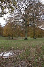
Fine view of May Hill geograph.org.uk 906969

May Hill is a prominent English hill between Gloucester and Ross-on-Wye. Its summit, on the western edge of Gloucestershire and its northern slopes in Herefordshire, is distinguishable by a clump of trees on its summit, which forms an official Site of Special Scientific Interest. It is reached by three public footpaths, two as parts of the Gloucestershire Way and Wysis Way.

Excerpt from the Wikipedia article May Hill (License: CC BY-SA 3.0, Authors, Images).

May Hill
Yartleton Lane, Forest of Dean Longhope

Geographical coordinates (GPS) Address Nearby Places
placeShow on map

Wikipedia: May HillContinue reading on Wikipedia

Geographical coordinates (GPS)

Latitude Longitude
N 51.890765 ° E -2.443869 °
placeShow on map

Address

Yartleton Lane
GL17 0NR Forest of Dean, Longhope
England, United Kingdom
mapOpen on Google Maps

Fine view of May Hill geograph.org.uk 906969
Share experience

Nearby Places

Hobbs Quarry SSSI, Longhope

Hobbs Quarry, Longhope (grid reference SO695195) is a 1-hectare (2.5-acre) geological and biological Site of Special Scientific Interest in Gloucestershire, England, notified in 1966. It is situated midway between Longhope and Dursley Cross in the Forest of Dean. Adjacent woods are Kiln Wood and Coleman's Wood. The site was managed by the Gloucestershire Wildlife Trust. Ownership changed to an independent Charitable Trust - Hobbs Nature Reserve Trust - on 1 August 2023. The Management Plan is similar to the one GWT had agreed with Natural England, combining conservation and research work on the geological exposures and preservation of the valuable natural environment. An explanatory website is under development to aid any groups planning educational visits. Local specialists are available to assist with these if required. The site is listed in the 'Forest of Dean Local Plan Review' as a Key Wildlife Site (KWS). The quarry is known for its geological exposures, and was originally about a mile long extending into Kiln Wood, which is to the north of this reserve. The southernmost part of the quarry was used as a public landfill site and destroyed and the northernmost part became under threat from fly-tipping. The Nature Conservancy Council designated the site an SSSI and undertook rehabilitation work. The Gloucestershire Wildlife Trust purchased the site in 1981. The Forest of Dean District Council provided grant aid.