Huntley, Gloucestershire
Forest of DeanUse British English from March 2015Villages in Gloucestershire

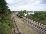
Huntley, Gloucestershire, is a village on the A40 located seven miles (11 km) west of Gloucester. It is in the north of the Forest of Dean.
Excerpt from the Wikipedia article Huntley, Gloucestershire (License: CC BY-SA 3.0, Authors, Images).Huntley, Gloucestershire
Whitlow Lane, Forest of Dean Westbury-on-Severn
Geographical coordinates (GPS) Address Nearby Places Show on map
Geographical coordinates (GPS)
| Latitude | Longitude |
|---|---|
| N 51.86356 ° | E -2.39262 ° |
Address
Whitlow Lane
Whitlow Lane
GL19 3EE Forest of Dean, Westbury-on-Severn
England, United Kingdom
Open on Google Maps


