place

Penmaenmawr

Pages including recorded pronunciationsPages with Welsh IPAPenmaenmawrTowns in Conwy County BoroughUse British English from September 2013
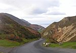
Penmaenmawr & Foel Lus geograph.org.uk 3153833

Penmaenmawr (, Welsh: [ˈpɛnmaːɨnmaur] ) is a town and community in Conwy County Borough, Wales, which was formerly in the parish of Dwygyfylchi and the traditional county of Caernarfonshire. It is on the North Wales coast between Conwy and Llanfairfechan and was an important quarrying town, though quarrying is no longer a major employer. The population of the community was 4,353 in 2011, including Dwygyfylchi and Capelulo. The town itself having a population of 2,868 (2011).It was named after Penmaenmawr mountain, which stands above the sea immediately west of the town. Much of its formerly rounded top (with an old hill-fort) has been quarried away, leaving the present-day lower flat top. The town was bypassed by the A55 Expressway in the 1980s, losing its old Edwardian period promenade in the process, which was largely replaced by a modern one. Penmaenmawr is noted for its spectacular mountain and coastal walks. Nearby are the popular attractions of Sychnant Pass and Mynydd y Dref, and the town also lies partly within Snowdonia National Park (Eryri).

Excerpt from the Wikipedia article Penmaenmawr (License: CC BY-SA 3.0, Authors, Images).

Penmaenmawr
North Wales Expressway,

Geographical coordinates (GPS) Address Nearby Places
placeShow on map

Wikipedia: PenmaenmawrContinue reading on Wikipedia

Geographical coordinates (GPS)

Latitude Longitude
N 53.27 ° E -3.928 °
placeShow on map

Address

Gwibffordd Gogledd Cymru / North Wales Expressway

North Wales Expressway
LL34 6NJ , Pen-Y-Cae
Wales, United Kingdom
mapOpen on Google Maps

Penmaenmawr & Foel Lus geograph.org.uk 3153833
Share experience

Nearby Places

Sychnant Pass
Sychnant Pass

Sychnant Pass (Welsh: Bwlch Sychnant, "Dry-stream Pass") in Conwy County Borough, Wales, links Conwy to Penmaenmawr via Dwygyfylchi. Much of the pass is in Snowdonia National Park, and a large area of land within it has been designated a Site of Special Scientific Interest. At the bottom is the village of Capelulo, which lends its name to the community of Penmaenmawr. Before the coming of the railway to the North Wales coast, the road through Sychnant Pass was the route of choice for mail coaches at high tide, when the faster and safer route along the sands was unusable. After leaving Conwy, the route runs westward through the valley on the south side of Mynydd y Dref (Conwy Mountain), which is topped by the hillfort of Castell Caer Seion. There are parallel tracks and footpaths (including the North Wales Path) on Mynydd y Dref for most of the way. Also Allt-Wen (837 ft, 255 m) and Penmaenbach (804 ft, 245 m) can be climbed from here. At the western end of the valley, the Sychnant Pass Road runs between the stone walls of the Pensychnant estate and through a narrow gap in the surrounding hills before descending steeply to the valley floor at Capelulo, reputedly the site of an early medieval chapel of Saint Ulo. Here there are two inns, a restaurant and a bistro, and in the ravine behind the inns is Nant Ddaear-y-llwynog (the Fairy Glen), a Victorian nature trail. From Capelulo it is an easy walk or short drive to the coast at Penmaenmawr.