Reuss (river)
Pages including recorded pronunciationsPages with German IPAReuss basinRivers of AargauRivers of Switzerland ... and 6 more
Rivers of the canton of LucerneRivers of the canton of UriRivers of the canton of ZugRivers of the canton of ZürichTributaries of Lake LucerneTributaries of the Aare

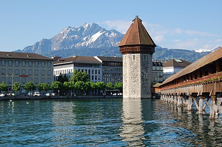
The Reuss (German pronunciation: [ʁɔɪ̯s] ; Swiss German: Rüüss) is a river in Switzerland. With a length of 164 kilometres (102 mi) and a drainage basin of 3,426 square kilometres (1,323 sq mi), it is the fourth largest river in Switzerland (after the Rhine, Aare and Rhône). The upper Reuss forms the main valley of the canton of Uri. The course of the lower Reuss runs from Lake Lucerne to the confluence with the Aare at Brugg and Windisch. The Reuss is one of the four major rivers taking their source in the Gotthard region, along with the Rhine, Ticino and Rhône.
Excerpt from the Wikipedia article Reuss (river) (License: CC BY-SA 3.0, Authors, Images).Reuss (river)
Militärstrasse,
Geographical coordinates (GPS) Address Nearby Places Show on map
Geographical coordinates (GPS)
| Latitude | Longitude |
|---|---|
| N 47.4909 ° | E 8.23193 ° |
Address
Militärstrasse
Militärstrasse
5412
Aargau, Switzerland
Open on Google Maps


