place

National Archaeological Museum of Altino

1960 establishments in ItalyArchaeological museums in ItalyBuildings and structures in the Metropolitan City of VeniceMuseums established in 1960National museums of Italy
Nuovo Museo Archeologico Nazionale di Altino

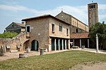
The National Archaeological Museum of Altino (in italian: Museo archeologico nazionale di Altino, MANA) is an archaeology museum next to the archaeological site of Altinum. It is located in the frazione Altino of the municipality of Quarto d'Altino, in the Metropolitan City of Venice. The museum, which preserves the most representative archaeological finds of Altinum, and the nearby archaeological site of Altino are included in the UNESCO World Heritage site "Venice and its lagoon".

Excerpt from the Wikipedia article National Archaeological Museum of Altino (License: CC BY-SA 3.0, Authors, Images).

National Archaeological Museum of Altino
Via Sant'Eliodoro,

Geographical coordinates (GPS) Address Phone number Website Nearby Places
placeShow on map

Wikipedia: National Archaeological Museum of AltinoContinue reading on Wikipedia

Geographical coordinates (GPS)

Latitude Longitude
N 45.5407 ° E 12.3981 °
placeShow on map

Address

Museo Archeologico Nazionale di Altino

Via Sant'Eliodoro 56
30020
Veneto, Italy
mapOpen on Google Maps

Phone number
MIBAC

call+390422789443

Website
polomusealeveneto.beniculturali.it

linkVisit website

Nuovo Museo Archeologico Nazionale di Altino
Share experience

Nearby Places

Ammiana

Ammiana was a settlement in an archipelago in the northern part of the Lagoon of Venice which has disappeared. Its islands were part of a larger number of islands in this part of the lagoon which also included the island group of the next-door settlement of Costanziaco (just to the east) and the islands of Torcello, Burano and Mazzorbo to the south-east. The islands of Ammiana were between the right and left banks of the lagunar channels which today are called della Dolce and San Felice. Another island, which was called tumba della Leseda and is now called La Salina, which lies on the right (eastern) bank of the San Felice channel, was also part of this settlement. Like other settlements on islands of this part of this lagoon, it flourished between the 7th and 13th century but declined in the 13th century due to deteriorating environmental conditions and was abandoned by the mid-14th century. Like the next door Costanziaco, some of its islands were subsequently submerged by the waters of the lagoon. The archipelago comprised the islands of Ammianella (which had the Santi Andrea e Giacomo monastery), Castrazio (which had the San Lorenzo church and monastery), Orti di Ammiana (which had the monasteries of Santi Filippo e Giacomo Apostoli, S. Marco, which was later renamed Santa Cristina, and the church and monastery of Sant’Angelo) and other islands which in the Middle Ages were called tumbae: tumba Ambrosii, tumba della Gaiada (which had the church and monastery of Santa Maria Maddalena della Gaiada) and tumba Leseda (which had the monastery of Santi Felice e Fortunato).Hardly anything is known about the life and politics of this settlement. There is only information form archival documents held in the island of Torcello, which at the time was the chief administrative centre of this part of the Lagoon of Venice. These are legal documents regarding transactions, such as sales and purchases of property, bequests and disputes. The documents have provided information about the churches and monasteries of these islands and their locations.