Moel Arthur
Hillforts in DenbighshireHillforts in FlintshireMountains and hills of FlintshireScheduled monuments in FlintshireUse British English from July 2022

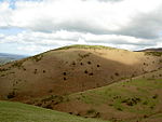
Moel Arthur ("Arthur's Hill") is an Iron Age hillfort in Flintshire, Wales, at the boundary with Denbighshire, about 5 miles (8.0 km) east of Denbigh. It is on a prominent hill, height 455.8 metres (1,495 ft), in the Clwydian Range; it overlooks the Vale of Clwyd to the west. Offa's Dyke Path skirts the hill. It is about 1 mile (1.6 km) south-east of the hillfort of Penycloddiau.
Excerpt from the Wikipedia article Moel Arthur (License: CC BY-SA 3.0, Authors, Images).Moel Arthur
Offa's Dyke Way,
Geographical coordinates (GPS) Address External links Nearby Places Show on map
Geographical coordinates (GPS)
| Latitude | Longitude |
|---|---|
| N 53.184444444444 ° | E -3.2805555555556 ° |
Address
Moel Arthur Hillfort
Offa's Dyke Way
LL15 1TD
Wales, United Kingdom
Open on Google Maps


