Doreen, Victoria
Suburbs of MelbourneSuburbs of the City of WhittleseaSuburbs of the Shire of NillumbikUse Australian English from August 2019

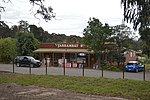
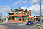
Doreen is a rapidly growing suburb in Melbourne, Victoria, Australia, 29 km (18 mi) north-east of Melbourne's Central Business District, located within the City of Whittlesea and Shire of Nillumbik local government areas. Doreen recorded a population of 27,122 at the 2021 census.Patrick Reid settled the area in 1844, calling it "Hazel Glen". The Post Office opened on 8 December 1870 as Hazelglen, and was renamed Doreen in 1895.The area has a community hall and a Country Fire Authority fire station.
Excerpt from the Wikipedia article Doreen, Victoria (License: CC BY-SA 3.0, Authors, Images).Doreen, Victoria
Doctors Gully Road, Melbourne Doreen
Geographical coordinates (GPS) Address Nearby Places Show on map
Geographical coordinates (GPS)
| Latitude | Longitude |
|---|---|
| N -37.605 ° | E 145.146 ° |
Address
Doreen Primary School
Doctors Gully Road 75
3754 Melbourne, Doreen
Victoria, Australia
Open on Google Maps


