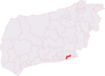
Lancing Ring

Lancing Ring is a 29.4-hectare (73-acre) Local Nature Reserve in Lancing in West Sussex. It is owned and managed by Adur District Council.This chalk grassland site is notable for butterflies, adders, and common lizards. There is also deciduous woodland with wildflowers including early purple orchids and a dew pond, the habitat of dragonflies such as the broad-bodied chaser, Libellula depressa, and numerous newts. There is access from Mill Road via the main car park and Halewick Lane has an area for parking beside the children's play area at the foot of the hill. There is a volunteer group that assists Adur District council with conservation management, the Friends of Lancing Ring, formed in 1989.
Excerpt from the Wikipedia article Lancing Ring (License: CC BY-SA 3.0, Authors, Images).Lancing Ring
Derek Road, Adur
Geographical coordinates (GPS) Address Nearby Places Show on map
Geographical coordinates (GPS)
| Latitude | Longitude |
|---|---|
| N 50.843 ° | E -0.323 ° |
Address
Lancing Ring Nature Reserve
Derek Road
BN15 0NU Adur
England, United Kingdom
Open on Google Maps


