Cremorne, Victoria

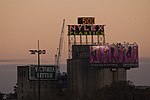
Cremorne is a small inner suburb of Melbourne, 2 km south-east of the CBD. Its local government area is the City of Yarra and at the 2016 Census it had a population of 2,018. It is bounded by the Yarra River, Punt Road, Swan and Church Streets, and divided down the middle by the railway to South Yarra. Covering only about a square kilometre, until 1999 Cremorne existed only as a locality in the larger suburb of Richmond. Cremorne's charm is in its rather chaotic mix of uses and the unique character resulting from being 'walled in' by main roads and railways on all sides. There are industrial icons such as Bryant and May and Rosella factories, and the Nylex Clock, side by side with Victorian cottages, modern townhouses, offices and light industries. Cremorne takes its name from the Cremorne Gardens, an amusement park which occupied a riverfront location in the western half of Cremorne for a period in the mid 19th century.
Excerpt from the Wikipedia article Cremorne, Victoria (License: CC BY-SA 3.0, Authors, Images).Cremorne, Victoria
Balmain Street, Melbourne Cremorne
Geographical coordinates (GPS) Address Phone number Website Nearby Places Show on map
Geographical coordinates (GPS)
| Latitude | Longitude |
|---|---|
| N -37.83 ° | E 144.993 ° |
Address
The Cherry Tree Hotel
Balmain Street 53
3121 Melbourne, Cremorne
Victoria, Australia
Open on Google Maps


