Lynbrook, Victoria

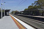
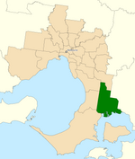
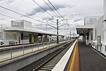
Lynbrook is a suburb in Melbourne, Victoria, Australia, 36 km south-east of Melbourne's Central Business District, located within the City of Casey local government area. Lynbrook recorded a population of 9,121 at the 2021 census.Lynbrook is positioned on the South Gippsland Highway, slightly north-west of Cranbourne, and just south of the residential suburb of Hampton Park. Lynbrook is bounded by Dandenong Hastings Road in the west, the South Gippsland Freeway in the north, by a line north of Merinda Park railway station in the east, and the railway line in the south.The suburb was developed by VicUrban, starting in 1994. A special feature of the VicUrban development is the stormwater catchment which flows into the lake and wetlands where it is purified before being released into Dandenong Creek and into Port Phillip Bay. Prior to 1994, the area now occupied by Lynbrook was part of Lyndhurst. There are two primary schools, one State and one Catholic. There is a central shopping centre with Coles and a range of strip shops with take away food and eateries, a gym, medical centre, pharmacy, news agency, butcher, bakery, and hair and beauty. There is also a Community Center, child care centres, vet, kindergarten and maternal child health nurse. Lynbrook has a local resident's group, the Lynbrook Residents Association (LRA), who advocate to Local, State and Federal Government on behalf of residents with local issues. They also host a number of Community Events to bring the community together to create a sense of belonging and community in Lynbrook.
Excerpt from the Wikipedia article Lynbrook, Victoria (License: CC BY-SA 3.0, Authors, Images).Lynbrook, Victoria
Hutchinson Drive, Melbourne Lynbrook
Geographical coordinates (GPS) Address Nearby Places Show on map
Geographical coordinates (GPS)
| Latitude | Longitude |
|---|---|
| N -38.05 ° | E 145.252 ° |
Address
Hutchinson Drive
Hutchinson Drive
3975 Melbourne, Lynbrook
Victoria, Australia
Open on Google Maps


