Hampton Park, Victoria

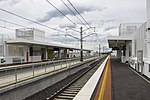
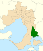
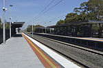
Hampton Park is a suburb in Melbourne, Victoria, Australia, 36 km south-east of Melbourne's Central Business District, located within the City of Casey local government area. Hampton Park recorded a population of 26,082 at the 2021 census.Hampton Park is bounded by the South Gippsland Freeway in the west, Centre Road in the north, a line generally parallel to Langbourne Drive in the east, and Glasscocks Road in the south.The original development of Hampton Park dates from the post World War I era, when the area around Somerville Road was subdivided, with the Post Office opening on 22 November 1920. Electricity was connected in Hampton Park in 1942 and town water in 1961. Until these services were connected the people relied on lamps and tank water for their light and water needs. Significant development of the area commenced in the 1970s, with development continuing through to the present. Development in the neighbouring Lynbrook estate commenced in 1994. The Hampton Park and Lynbrook areas have significant areas of land remaining for development. Hampton Park, Lynbrook and Lyndhurst form a growing residential area that has experienced a significant increase in population from 1996 to 2001. This increase in population has occurred due to an increase in the dwelling stock from 1996 to 2001.
Excerpt from the Wikipedia article Hampton Park, Victoria (License: CC BY-SA 3.0, Authors, Images).Hampton Park, Victoria
Hampton Drive, Melbourne Hampton Park
Geographical coordinates (GPS) Address Nearby Places Show on map
Geographical coordinates (GPS)
| Latitude | Longitude |
|---|---|
| N -38.029 ° | E 145.26 ° |
Address
Hampton Drive
Hampton Drive
3976 Melbourne, Hampton Park
Victoria, Australia
Open on Google Maps


