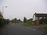
Seend Cleeve Quarry
English Site of Special Scientific Interest stubsQuarries in WiltshireSites of Special Scientific Interest in WiltshireSites of Special Scientific Interest notified in 1987Wiltshire geography stubs
Seend Cleeve Quarry (grid reference ST933609) is a 7.5 acres (3.0 ha) Geological Site of Special Scientific Interest at Seend Cleeve, Wiltshire, England, notified in 1987. It is important for its strata from the Oxfordian stage of the Jurassic period, containing fossil ammonites and bivalves which aid stratigraphy.The site was an iron ore quarry between the middle of the 19th century and the 1960s, and in the 19th century Seend Iron Works was nearby. None of these facilities have been preserved; the site is now pasture.
Excerpt from the Wikipedia article Seend Cleeve Quarry (License: CC BY-SA 3.0, Authors).Seend Cleeve Quarry
Pelch Lane,
Geographical coordinates (GPS) Address Nearby Places Show on map
Geographical coordinates (GPS)
| Latitude | Longitude |
|---|---|
| N 51.3471 ° | E -2.0976 ° |
Address
Pelch Lane
Pelch Lane
SN12 6PY , Seend
England, United Kingdom
Open on Google Maps


