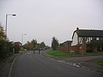
Sandridge, Wiltshire

Sandridge is a dispersed rural community to the east of Melksham, Wiltshire, England. It is part of the civil parish of Melksham Without. An Ordnance Survey map of 1961 names a settlement at Sandridge Hill, 2.5 miles (4.0 km) east of Melksham, and a hamlet of Sandridge, 0.25 miles (0.4 km) to the north; as of 2015 these names are no longer in gazetteers and Sandridge refers to a wider area along the A3102, with Sandridge Common identified on road signs near Melksham. A National School was built in 1873 at Sandridge Common, on land given by Ralph Ludlow Lopes and educated children of all ages until 1953; around that time it became known as Forest and Sandridge Church of England Primary School. In 2015, to cater for the eastward expansion of Melksham, the school moved to a new building on the outskirts of the town.
Excerpt from the Wikipedia article Sandridge, Wiltshire (License: CC BY-SA 3.0, Authors, Images).Sandridge, Wiltshire
Sandridge Hill,
Geographical coordinates (GPS) Address Nearby Places Show on map
Geographical coordinates (GPS)
| Latitude | Longitude |
|---|---|
| N 51.38 ° | E -2.1 ° |
Address
Sandridge Hill
Sandridge Hill
SN12 7QX , Melksham Without
England, United Kingdom
Open on Google Maps


