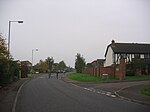
Keevil
Civil parishes in WiltshireEngvarB from August 2019OpenDomesdayVillages in Wiltshire

Keevil is a village and civil parish in Wiltshire, England, about 4 miles (6 km) east of the centre of Trowbridge and a similar distance south of Melksham. The village lies on a slope between Great Hinton and Bulkington. Semington Brook forms much of the northeast boundary of the parish.In the far north of the parish, on the A361, is the hamlet of The Strand.
Excerpt from the Wikipedia article Keevil (License: CC BY-SA 3.0, Authors, Images).Keevil
Main Street,
Geographical coordinates (GPS) Address Nearby Places Show on map
Geographical coordinates (GPS)
| Latitude | Longitude |
|---|---|
| N 51.321 ° | E -2.115 ° |
Address
Main Street
Main Street
BA14 6LX , Keevil
England, United Kingdom
Open on Google Maps


