Antony, Cornwall

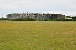
Antony (Cornish: Trevanta) is a coastal civil parish and a village in Cornwall, England, United Kingdom. The village is situated on the Rame Peninsula about three miles west of Torpoint and has a shop, a pub and a garage. There are two possible etymologies of Antony: the first is that it is named in honour of St Anthony; the second is that it comes from the Anglicisation of the Cornish Tre- (“farmstead”) and -Anta (personal name)Antony parish is bounded to the north by the tidal River Lynher (also known as the St Germans River) and to the south by the English Channel coast. To the east, the parish is bordered by Torpoint and St John parishes and to the west by Sheviock parish.The parish is in the St Germans Registration District and had a population of 436 at the 2001 census, increasing to 500 at the 2011 census. Apart from the church town, Antony, the only settlement of any size is Wilcove. Scraesdon Fort and Antony House are also in the parish. At the time of Domesday Book (1086) the manor of Antony was held by Ermenhald from Tavistock Abbey.
Excerpt from the Wikipedia article Antony, Cornwall (License: CC BY-SA 3.0, Authors, Images).Antony, Cornwall
Antony Hill,
Geographical coordinates (GPS) Address Nearby Places Show on map
Geographical coordinates (GPS)
| Latitude | Longitude |
|---|---|
| N 50.37 ° | E -4.252 ° |
Address
Antony Hill
Antony Hill
PL11 3AF
England, United Kingdom
Open on Google Maps


